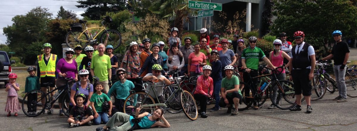
While waiting for SDOT to get back to us on our April 28 (!) action requests for biking to the bridges, we did some of it ourselves, with folks from Highland Park Action Committee and the West Duwamish Greenbelt Trails Group.
Category: Uncategorized
Black Lives Matter
We need to turn our feelings of outrage about the unjust killing of George Floyd into love and action for racial justice in everything we do.
We share the outrage that has filled streets in Seattle and across the world over George Floyd’s murder at the hands of Minneapolis police. We grieve for his family, for Breonna Taylor’s, and for the families of hundreds of others who are killed by police each year (1,000 Americans are killed by police yearly — these deaths fall disproportionately on Black men).
We are also heartbroken and enraged by the killing of Ahmaud Arbery, a young man out for his regular run in his South Georgia neighborhood.
The awful truth is that in America, including here in Seattle, running while Black, biking while Black, walking while Black, driving while Black, even just being in parks and other public space while Black can trigger police intervention, hate-based harassment, and worse. This atmosphere of terror for people of color, Indigenous people, and especially Black people, cannot continue.
Our vision is rooted in safe, comfortable, accessible streets; in the belief that the ability to get around safely, to the daily necessities of life, is a basic human right. This includes the right to not be murdered by police or civilian racists and the right to assemble in public spaces to demand justice (“Whose streets? Our streets!” “Black Lives Matter!” “Say his name! George Floyd!”) — without being corralled, tear-gassed, pepper-sprayed, beaten, or shot with rubber bullets and flash grenades.
Our commitment now is to continue to advance community-led solutions for street and public space improvements; to implement our racial equity action plan at every level of our organization; and to build solidarity with Black people, Indigenous people, and all people of color in the fight to dismantle white supremacy and racism. There is a long way to go and difficult self-reflection to undertake, but we are committed to doing our part to advance racial justice in Seattle so that everyone can exist, enjoy, protest, and travel safely on our streets.
WSBC Monthly Meeting Tuesday June 2
Please join us for an online meeting, 6:30 to 8:00 pm.
Draft agenda includes:
- next steps for making biking and walking safe during the high bridge closure?
- what’s working and what could be improved for Stay Healthy Streets?
- rides – when can we resume rides? planning for next Cycle History with SWSHS
- how does racism affect safety while walking and biking on our streets?
Email us at westseattlebikeconnections@gmail.com to receive login information. Include your name, neighborhood and something you are interested in, so we know you are a real person. [We will not share or use your email address for any other purpose.]
Avalon Way Thank You
Doug Ollerenshaw is a year-round bike commuter and former professional bike racer. But he was not comfortable riding with his young son on Avalon Way SW. No longer! Here is Doug’s (and our) message of thanks to SDOT. This is what “Complete Streets” are all about.
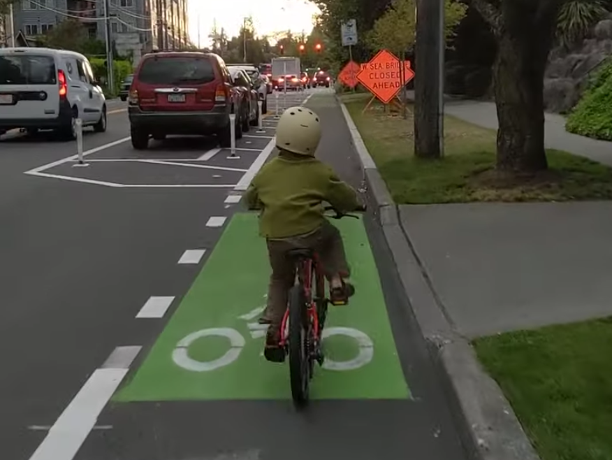
Living in North Delridge, my family and I have always loved visiting businesses in Alaska Junction, but found it nearly impossible to get there safely by bike. So I was extremely excited to see the Avalon Way protected bike lanes being installed. Finally there is a family friendly route between our neighborhood and the commercial center of West Seattle. And last week, we had a major milestone, with our son seven year old son, Elliott, finally making the ride up the hill under his own power.
After another long day of online learning, Elliott and I set off from our home, northbound on the 26th Ave greenway. We used quiet Nevada street to connect up to 30th Ave (there was a little walking involved on Nevada!), then took advantage of the 30th Ave being closed at its northern end to all but bikes and pedestrians to connect to Avalon itself. From there, what would previously have been a stressful uphill ride in a narrow bike lane was, instead, a stress free cruise. With a row of parked cars separating us from from the motor vehicle lane, I didn’t have any worries about the Metro bus, the box truck, and the other assorted traffic passing by. In my excitement, I took a quick cellphone video, linked here.
Elliott was so proud of himself for making it all the way up the hill, and I was incredibly grateful that he had a safe space in which to do it. We’re both excited for the day when businesses reopen and I can reward him with a big Husky Deli ice cream cone at the top.
Thanks, too, to Councilmember Lisa Herbold, and the to the Luna Park business owners who worked openly and honestly with us during the planning of this project.
Roxbury gets a little love
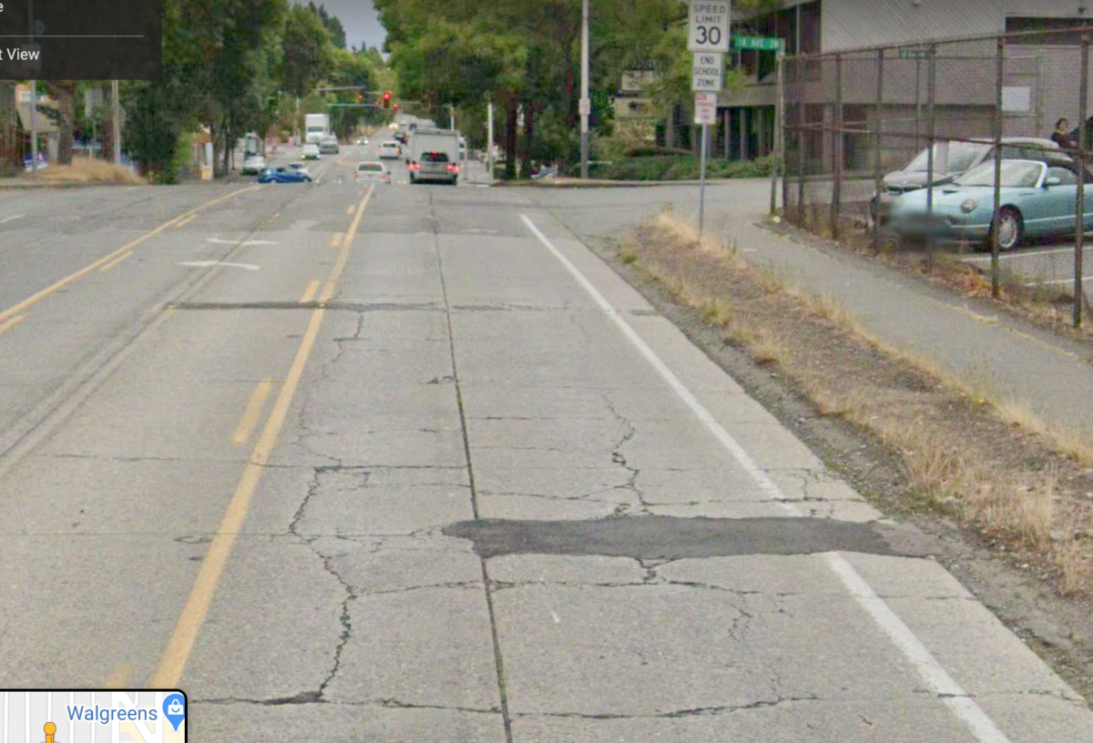
SDOT is planning to repave SW Roxbury Street from 16th to 18th Ave SW next week.
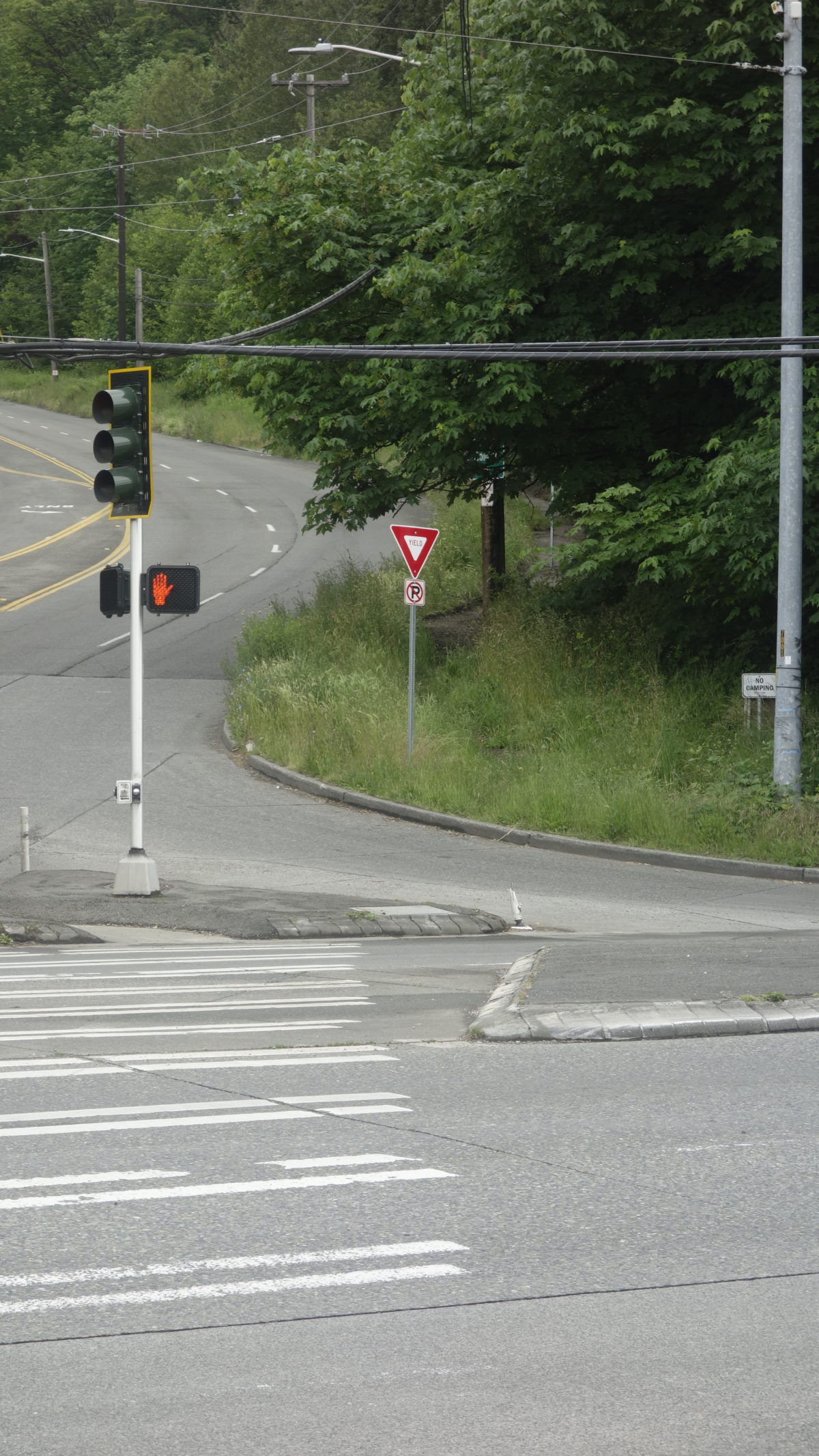
Roxbury is a key east-west street, especially with the WS bridge out. If you were choosing an east-west bike route across the south end, this would be it for directness and grades. But It has some of the roughest paving in West Seattle, and incomplete, substandard bike lanes. It’s Move Seattle Levy complete repaving project scheduled for 2019 was canceled. Smoothing out paving is not all that is needed on a street where bike riders mix with buses and lots of cars, but it will help. We will appreciate the smoother paving for these two blocks while trying to track a straight line in front of the buses and trucks.
Unfortunately, this work misses the next block west, where a rutted, half gravel gutter masquerades as an uphill bike lane. Photo above. SDOT’s announcement says this “…does not preclude … future safety Improvements…”. We’ve asked for bike/ped safety improvements in the very near future.
Essential bikers
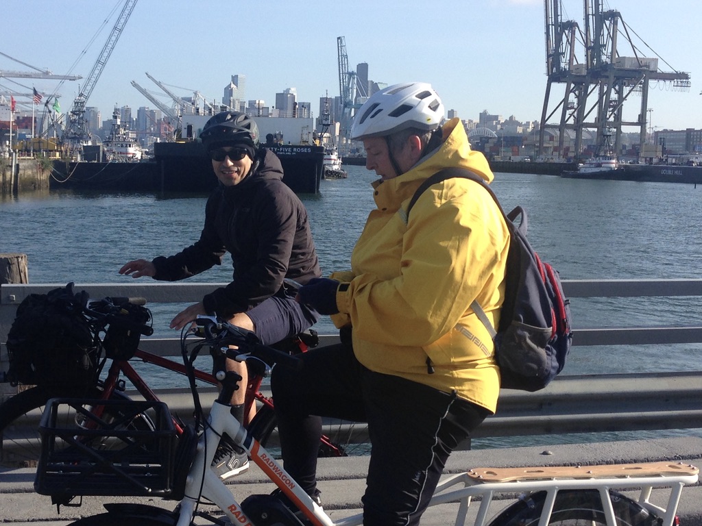
Today at the east approach to the Spokane St Bridge, we met Seattle fire fighter Aaron and paramedic Kelly on bikes, returning home to West Seattle after their shifts. They carry all the gear they need on their e-assist cargo bikes. More than 100 Seattle fire fighters live in West Seattle. Many are turning to biking for the most reliable way to get to their stations. Likewise, over the past couple of weeks, West Seattle Bike Connections has given medical personnel custom bike routes to get from home to UW Medical Center, Pac Med, the VA Hospital and Swedish Cherry Hill medical center. Bike sales are through the roof at local shops.
As part of contingency planning and mitigation, we need the City to implement key bike safety improvements now for safe, efficient routes to the Spokane St Bridge, 1st Ave S Bridge and South Park Bridge.
Duwamish Valley Safe Streets, West Seattle Bike Connections, Seattle Neighborhood Greenways and Cascade Bicycle Club sent a memo to SDOT proposing strategies and actions. Sam Zimbabwe has promised a response.
WSBC May 5 2020 meeting
Let’s stay in touch without touching.
Meeting Tuesday evening 6:30 pm to 8:00 pm
Agenda
- Check in. How are you doing?
- Stay Healthy Streets: What do you see? Are they working to meet needs?
- Unhealthy Bridge: What next on our proposals to SDOT for biking improvements?
- What should we do about Bike Everywhere Day, social rides, and test rides for new bike commuters?
Join Meeting
https://zoom.us/j/292902519Meeting ID: 292 902 519
One tap mobile
+16699006833,,292902519#Dial by your location
+1 669 900 6833
Tbere will be a waiting room for screening before you can enter the meeting.
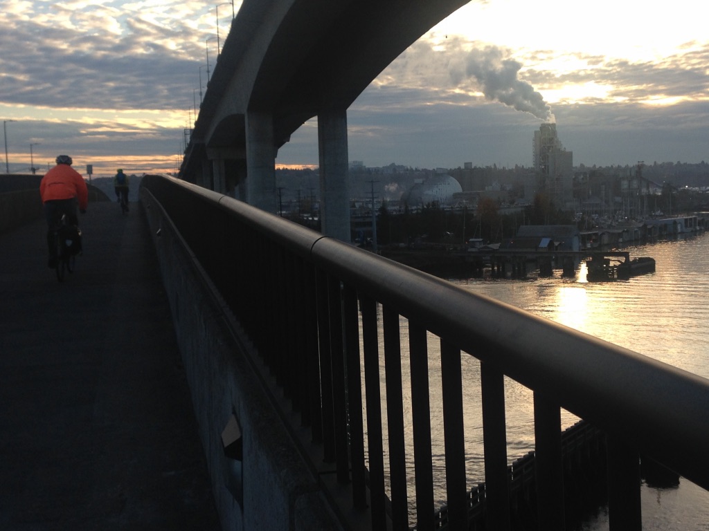
Bike Options without the WS Bridge
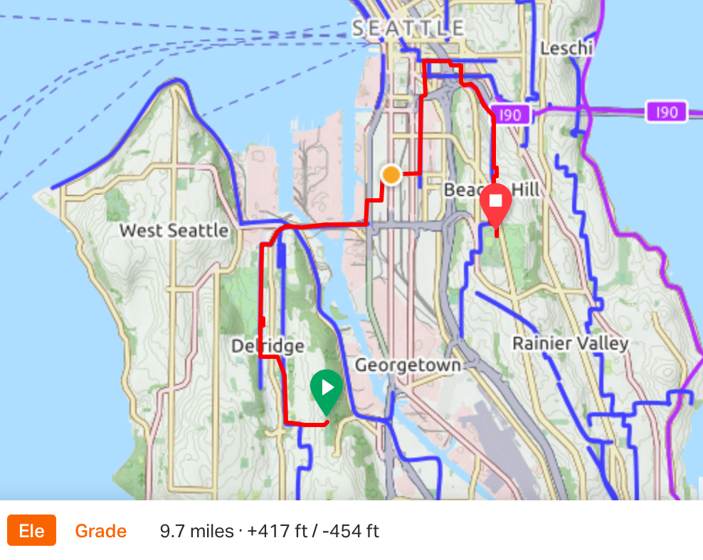
This week, we helped Emily find a bike route from Admiral to work at the VA Hospital on Beacon Hill. And Regan, who was looking for a safer way to ride from White Center to South Park and Georgetown. If you are looking for alternative ways to get to an essential job, do an essential errand, or some socially distanced exercise, and deal with closure of the West Seattle Bridge, this would be a great time to try it by bike.
Need a route? See our Resources page for mapped routes. Print or download for visual and audible turn-by-turn cues. If you don’t see what you need, email us. We’ll send you a custom route map, and connect you with a volunteer buddy for a (socially distanced) test ride if you like. westseattlebikeconnections (at) gmail (dot) com
The Spokane Street Bridge (the “low bridge”) has a nice wide pedestrian and bike path fully separated from the heavy truck traffic. It connects to several good bike routes to SODO, Pioneer Square, Downtown, Beacon Hill and beyond. The Duwamish Trail gets you to the First Avenue South Bridge and Georgetown, or into South Park. The South Park Bridge also takes you to Georgetown.
April 7 2020 Virtual Meeting
In response to COVID-19 mandates, our open meeting at Neighborhood House is canceled. We will substitute a closed video conference meeting. Invitation with login information was sent yesterday to our Google Group. Next regular meeting is scheduled for May 5. We’ll wait and see.
Be well.
Bike Shops are Essential
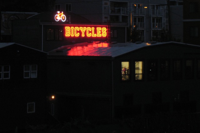
Bike shops are essential businesses, as you know whenever you have maintenance or repairs you can’t handle on your own, and need that bike to get to where you need to go. The Governor says so. We are lucky to have four shops in West Seattle and White Center, all open for business. Let’s help them stay open. It would be good to call first to make an appointment and check protocols. Here are phone numbers with currently posted hours:
Aaron’s Bicycle Repair, 9614 16th SW, White Center, 206-938-9785, Tue-Fri 11-2, 3-7; Sat, 11-7.
Alki Bike & Board, 2606 California Ave SW, Admiral District, 206-938-3322, Sun-Thu 12-6, Fri 10-6, Sat 11-6.
Cycle Therapy, 2532 Alki Ave SW, Alki Beach. 206-566-6616, Wed-Fri 10-7, Sat 10-6, Sun 11-4.
Westside Bicycles, 3418 Harbor Ave SW near Spokane/Avalon, 206-432-9982. Tue-Fri 10-7, Sat 10-6, Sun 12-5.
They can order just the right part or tool, too, for doing it yourself.