It’s a perfect day for a ride! Come join us at Delridge Community Center at 12:30 for an easy pace ride into Georgetown and South Park.
More on our Events page.
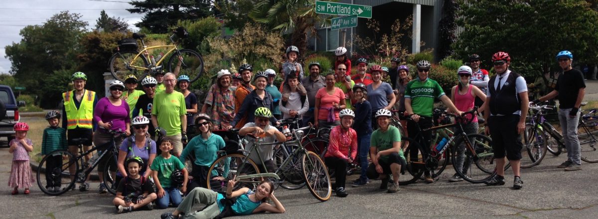
It’s a perfect day for a ride! Come join us at Delridge Community Center at 12:30 for an easy pace ride into Georgetown and South Park.
More on our Events page.
Lot’s of us use it to get to downtown, SoDo, Beacon Hill, points north and east. Ten times as many would ride if this couple miles was more comfortable and safe. Others would ride south of Spokane Street if there was a way.Planning is beginning to finally make that happen. Here’s the opportunity to weigh in when it makes the most difference! Please do!
http://www.seattle.gov/transportation/eastmarginal.htm


The Delridge Rapid Ride H-Line onlne open house is open for comment. Please comment! SDOT and Metro are offering two unacceptable choices for riding on Delridge. Participate and let them know in the last “essay” question that “NONE OF THE ABOVE” is the answer. We expect full implementation of the Bicycle Master Plan with protected bike lanes on Delridge.
https://rapidridehline.participate.online/
Riding a bicycle to and through West Seattle can be challenging due to limited safety provisions for people on bikes, and many hills. Delridge Way Southwest is one of the few north-south connections through West Seattle (along with 35th and Fauntleroy). It is the only major connection for the eastern portion of West Seattle. Delridge Way connects the West Seattle Bridge on the north to White Center on the south, while providing access to other important destinations including the Delridge Library, Boren STEM K-8 school, Southwest Pool, Chief Sealth High School, Denny Middle School, and Westwood Village. It is the only reasonably flat and evenly graded valley route connecting these destinations.
Although the proposed RapidRide H line is promising in terms of overall transportation improvements, there must also be a protected bike lane on the full length of Delridge Way for the people who already use this corridor and ride bicycles, and more importantly, for people who would if it was safe.
Seattle’s Comprehensive Plan calls for much greater use of bicycles for transportation. The City’s Climate Action Plan goals depend upon a significant increases in bicycle use. We are not yet on track to meet the 2035 goals. The Seattle Bicycle Master Plan calls for protected bike lanes on Delridge to meet these transportation and climate action goals. Provisions for safe bike riding are by far the least expensive way to add capacity to our streets and absorb population growth without adding to traffic congestion. The public health and safety benefits are obvious.
Many parts of Delridge Way SW are very wide, especially the areas north of Kenyon St. to the West Seattle Bridge. These portions could readily include continuous protected bicycle lanes on both directions with minimal disruption to traffic, parking, or existing street trees. On the south portion of the corridor, especially south of Henderson St/Barton Pl, there again are wide streets that can accommodate bicycle infrastructure. We acknowledge that the few blocks immediately to the south of Kenyon St are narrow. We ask that on this short important stretch some parking be removed to provide, at a minimum, standard width bike lanes.
There are no viable alternative routes to Delridge. Members of West Seattle Bike Connections and Seattle Neighborhood Greenways spent considerable effort mapping and then attempting to ride potential alternative, parallel routes. Coming into West Seattle from the north, access to the existing Delridge-Highland Park greenway is immediately challenging because of the steep grade at Andover. Further south, there are multiple further challenges including extreme elevation changes near Sanislo elementary school and unsafe traffic conditions around Dumar. This Greenway, while immensely useful to residents on the east side of West Seattle, does not connect well to destinations in the valley (schools, library, community center, and shopping).

The 26th Ave Greenway provides a valuable parallel route as far south as Juneau, but dead-ends beyond. A steep climb from Juneau along Croft Pl would allow connection to the Delridge-Highland Park Greenway, but the grade is too steep to meet the standards of an all ages, all abilities route. Once Delridge narrows at Kenyon, it is possible to cut over on the unpaved right-of-way at Elmgrove to 22nd. Continuing south on 22nd, there are two major unprotected crossings at Thistle and Trenton, ending at a set of stairs at Barton to reconnect to Delridge or continue south on 21st.
Given no reasonable alternative, Delridge itself requires protected bike lanes. The traffic lanes are wide, so despite recently lowered speed limits, many drivers still pass through the area at uncomfortable speeds for people on bikes. As the flattest route through this part of the city, it is the only logical connection to improve to increase bicycle use for transportation, especially with great connections to schools and other destinations.

We supported the Move Seattle Levy that promised to improve Delridge as a multi-modal corridor. We ask that the City deliver on that promise. We ask that the City follow its plans, and make Delridge a Complete Street.


Support the Fauntleroy Boulevard Project – Walk & Talk this week with SDOT. Thursday 3/16 12n and Saturday 12/18 at 10am. Meet at LA Fitness, 3900 SW Alaska.
Seeing the design nearing completion, our members from all over the West Seattle peninsula continue to offer strong support for the Fauntleroy Boulevard Project.
Planned with extensive business and resident involvement over many years, this project will create a welcoming entry to West__ Seattle. The street improvements will make it possible for this rapidly developing urban village to absorb more density without increasing traffic congestion. These street improvements must be made as the one- and two-story commercial strip buildings are being replaced by five- and six-story mixed use buildings. By giving people safe and attractive places to walk, wait for a bus, and ride bikes, more people will use those transportation options instead of driving cars alone.
The project will also make it safe and efficient for people traveling to and through the area by bike, bus and truck. Fauntleroy Way SW is a key through-bike commute route, a transit route, a shopping destination, the auto approach to the West Seattle Bridge, and a Major Truck Street. Separation of bike traffic from heavy vehicle traffic here is vital for our safety. There are good reasons the Bicycle Master Plan calls for protected bike lanes on Fauntleroy
These elements in the design are essential for safety for people on bikes and on foot:
And last but not least, we would like to point out that riding bikes is good for local businesses! When we ride, we shop locally. When we ride, we save car parking for others.


Please join us to talk about using bikes to get around West Seattle, and celebrate our Ride in the Rain Challenge this month at Talerico’s Pizzeria. Open to all.
6:30 to 8:00 Tuesday, December 6
4718 California Ave SW in the Junction, near SW Alaska St.
Our team of eight was #34 of 454 teams! Let’s raise a glass and have some pizza and good conversation.
Other topics: Greenway routes in the 35th Ave SW corridor, and Fauntleroy Boulevard Project resumes design work.
For safety improvements at the intersections of SW Spokane/ Alki Trail/ Harbor Ave SW/ Avalon Way/ SW Manning. Ranked #1 in the city of the 12 projects awarded from the 40 proposals that made it through the District Council voting and SDOT vetting.
Background here and SDOT evaluation here.

Ranked high because the need is so obvious for better crossing safety for people walking and riding bikes. And because under Jodi Connolly’s leadership, with Bill Gobie’s ideas, we worked put together a coalition with Tony Fragada and Alki Community Council, Luna Park Neighbors, Nucor Steel, and got support from David Whiting of Admiral Neighborhood Association and SW District Council, and worked with Luna Park businesses to make sure their needs are included. Thanks to Dongho Chang, SDOT Chief Traffic Engineer, for coming out to observe conditions and steer us in the right direction. Thank you to Joe Laubach and all members of the Move Seattle Oversight Committee for supporting this project!
Urbanist article here about all of the projects. Would be great to see more of them funded!

Neighborhood Street Fund Grants come up every three years, for projects in the $100-500K range. Year 1: selection. Year 2: design. Year 3: construction.
You are invited to join this open meeting.
6:30 to 8:00 pm at HomeStreet Bank, 42nd Ave SW and SW Alaska Street
Let’s work together to improve conditions and enjoy bike riding in West Seattle. Proposed greenway routes along the central spines of WS are on the agenda, along with World Day of Remembrance, Fauntleroy,…
 Print: “The Politicians” by Jose Guadelupe Posada in 1890, Mexico.
Let’s keep our saints alive and riding este’ dia de los Muertos and election season.
 Cascade Bicycle Club, the Yes! Foundation, the White Center CDA and King County joined together to convert little used tennis courts into a unique “bike playground”. Opened on Saturday. Lots of kids riding around in the rain, learning about watching for traffic, using lanes, signaling, merging, yielding, stopping, and having fun! Take your young rider to Dick Thurnau Park (formerly Lnkewood Park) and try it out.
The bridge goes sideways, and so do the bike counts this year.
Up just 1.8% year to date over last year. June and July were lower, after an amazing Viaduct-closure boost in May. August was up. Pretty much the same pattern at the Fremont Bridge.
If you or someone you know decided ride in May during the Viaduct closure, and then went back to car or bus: What made you decide not to continue commuting by bike? 
Designed, with years of community input.
The next step: SDOT, the Mayor and City Council need to get it funded for construction.
Didn’t happen last year. Let’s let them know we want it in the budget this year! It’s a key element of West Seattle’s development in the “Triangle” east of the West Seattle Junction, and in the Bicycle Master Plan’s citywide routes. It is a major corridor for buses, bikes, trucks, and car traffic going out of West Seattle to downtown to Vashon Island. We need it, to help West Seattle absorb growth gracefully, and enable people in all those new buildings to safely walk, ride bikes and ride buses instead of driving everywhere.
Like, share, meet with us tomorrow to help develop support!
http://www.seattle.gov/transportation/FauntleroyWySWBlvd.htm