Bike Master Plan Update Comments / Deadline

Deadline for public comments to SDOT is this Friday, July 26.
Seattle Bike Master Plan Update
West Seattle Bike Connections submitted group comments last December. We met twice as a group with SDOT staff, participated in the public workshops, and just submitted detailed comments and a “report card” on the changes made in the June 2013 draft compared with the December 2012 draft.

SDOT bike planners, traffic engineers, and their planning consultants at Alta are working hard to make this a world-class plan for bicycle transportation. We appreciate their good work. But they don’t know every aspect of the city, and that’s where we come in. If you send your own comments on areas important to you, we will give West Seattle a strong voice in this important planning and policy document.

A plan does not guarantee that the planned improvements and programs will be funded, but if something is not included in the plan, it will be much less likely to ever be budgeted by the Mayor, funded by City Council, or implemented by SDOT.

WSBC_2013BMPDraft_ReportCard

121213-WSBC-SDOT-SW-lg

State Transportation Funding & West Seattle Bridge Trail

This received today from our West Seattle state Representative Joe Fitzgibbons. Thank you, Joe!

“Thanks for reaching out to let me know how important transportation safety programs are for you and for our state.  The House passed a transportation package today that includes an amendment I sponsored to put $16 million in pedestrian and bicycle safety projects around the state.

“One of the projects is an investment of $500,000 that will be provided to make improvements to the West Seattle Bridge Trail, making this commonly used, but dangerous, route safer and more accessible for the many folks who right now are risking their lives using this trail.

“While it is unclear what will happen to this bill in the Senate, I will keep working towards its final passage and try to hold on to the pedestrian and bicycle safety funding that is in the current transportation package.

“Thanks again for contacting me and please feel free to keep in touch with your questions and concerns.

“Take care,”

Joe Fitzgibbon
State Representative
34th Legislative District
Joe.Fitzgibbon@leg.wa.gov

Bike Master Plan – Test Questions

Test questions revealed in advance of SDOT’s June open houses!

REPORT CARD     June 2013 Seattle Draft Bicycle Master Plan Update for SW Sector           

This is what we asked SDOT to add to the first draft of the plan update, in December 2012.

(this is not everything in the draft plan — only what we thought was missing last fall.)

How does the June 2013 draft respond? Attend an open house, then let us know!


# Description Notes Grade
1 East Marginal Way S / Alaskan Way S from S Spokane Street to S Atlantic St:  separated cycletrack or off street path     
2 SW Avalon/ Fauntleroy Ave SW, 35th, 36th & 37th Ave SW: intersection and bike lane or cycle track improvements, and add route on 36th Ave SW from SW Avalon to SW Alaska     
3 Connection on East Marginal Way S. from S Spokane Street to Diagonal Way S, Off road path or cycletrack needed on west side of East Marginal Way S.     
4 Fauntleroy to SW Morgan St. via 38th Ave SW: Enhanced street.     
5 Fauntleroy, from SW Alaska to California Ave SW “in-street, major separation”. At least bike lanes both directions of travel.     
6 Greenway route to east of California Ave SW from SW Holgate to Ferry Ave SW via 40th, Walnut SW, 41st SW or 42nd SW.     
7 North Delridge Greenways: add E-W connection at south end of Greenway on 26th Ave SW.  Bike ramp or runnel at steps.     
8 “Brandon Green Super Highway” three new bike/pedestrian staircases or paths along currently unimproved sections of the SW Brandon St. right-of-way: between 16th & 17th SW, between 21st & 23rd SW, and between 30th & 34th SW     
9 SW Portland St:  Extend the Greenway to the East to reach 9th Ave SW (top of SW Highland Park Way)     
10 SW Trenton from 9th Ave SW to 35th Ave SW:  bike lanes or Greenway.     
11 24th Ave SW from SW Cloverdale to SW Thistle: Greenway.     
12 Highland Park Greenway and Westcrest Park trail, and connections into campus of South Seattle Community College, with further Greenway/Trail route to north.     
13 West Marginal Way SW, south of SW Michigan to 2nd Ave SW: Major separation or cycle track.     
14 S Horton Street in SODO from East Marginal Way S to 4th Ave S. – minor in street separation or enhanced street with safe crossing at East Marginal Way S     
15 SW Andover from Delridge SW to 22nd Ave SW: connect 21st Ave Greenway and Delridge Trail from West Seattle Bridge to routes to west via Andover.     
16 37th Ave SW between SW Hudson and SW Alaska: an “enhanced street”     
17 Delridge SW to SW Holden –  Add a trunnel up the stairway.     
18 West Duwamish trail through South Park – coordinate with King County portion to connect with Seattle     
19 Extend the off-street West Marginal trail into South Park along S. Portland St. Cross Holden at the WA-99 light, use WSDOT right-of-way to connect to S Portland St, and add an off-street trail along Portland to 8th Ave S.     
20 Greenway route along Duwamish River in South Park: Connect the West Duwamish trail to the 14th Street Bridge via S Kenyon St, S 10th Ave, and Dallas Ave S.     
21 SW Admiral Way westbound (uphill) from Spokane St/ Avalon/ Harbor Avenue SW:  Improve connection for access to Admiral.     
22 Beach Drive SW into north end of Lincoln Park multi-use path – add connection.    
23 West Marginal Way SW and Highland Park Way SW: Redesign Northwest corner of to avoid collection of dirt and gravel.    


East Marginal Way – with SDOT

Notes from May 17 meeting at Seattle Department of Transportation

Attending from SDOT:

Dongho Chang, City Traffic Engineer

Monica DeWald, Traffic Management Division, Pedestrian & Bicycle Program

Christopher Eaves, Traffic Management Division, Port and Freight


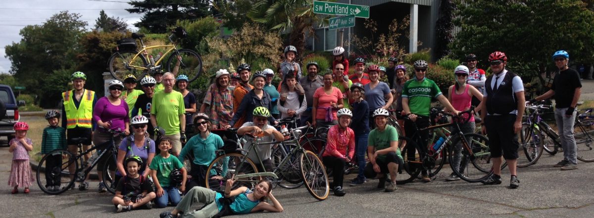
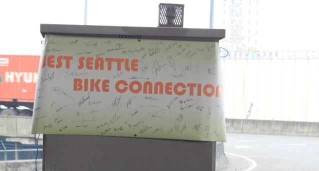
Attending from West Seattle Bike Connections:

Sakaru Tsuchiya, civil engineer specialist in pedestrian and bike facilities

Bob Anderton, attorney at Washington Bike Law

Jeff Hallman, VP of West Seattle Bike Connections, industrial design engineer

Don Brubeck, President of West Seattle Bike Connections, architect


Dongho Chang led the meeting, inviting our input. He noted that SDOT’s concern is to improve safety and legibility of the bike route for the benefit of bike riders and car and truck drivers. SDOT has been out observing conditions, doing traffic counts and talking to other stakeholders over the past two weeks since Lance David’s death in the crash at Hanford on May 1. We used a video from Monica’s bike commute from West Seattle to look at specific conditions.


Mayor McGinn has proposed allocating $700,000 in saving from the Spokane Street Viaduct project to immediate short-term improvements to East Marginal Way and WS Bridge Trail bike facilities, and $200,000 to design for ultimate long-term improvements. The engineering design would be enough to have a project ready to be eligible and competitive for construction funding grants.


This funding requires City Council approval.

We need to let City Council members know that we want this to happen!


Our requests for short-term improvements:

  1. Patch the pavement in bike lanes and at crossings.
  2. Sweep the streets on a frequent basis, due to deteriorated pavement.
  3. Build a safe crossing at Horton or Hanford, efficient for bikes, predictable for drivers.
  4. Fill the large puddles and provide drainage.
  5. Improve the sidewalk on west side to make it a safe, usable pedestrian/bike path. Move fire hydrants, trees between Spokane and Horton, utility poles and signs out of the sidewalk on the west side.
  6. At S Atlantic St/Alaskan Way transition to Portside Trail at Terminal 46:
    1. adjust the aiming of the traffic light video sensor to better detect northbound bikes in bike lane;
    2. add signage or pavement graphic to show northbound bikes where to stop;
    3. change southbound signal to be normally green instead of normally red for southbound ped/bike traffic, with vehicle sensors to change it to red southbound and green east-west or northbound left when needed.
  7. Request Port of Seattle to improve sightlines at terminal entries and exits by making fencing transparent or revising it for better sight triangles at curb cuts.
  8. Promote the improved multi-use path on Spokane St east of East Marginal Way to 6th Ave as option to get into SODO or other destinations to NE.


This funding requires City Council approval.

We need to let City Council members know that we want this to happen!


Long-term:

  1. Physical barrier separating bike from vehicle lanes on East Marginal Way from Spokane to Atlantic, connecting WS Bridge Trail to Portside Trail to Central Waterfront.
  2. Safe crossing at Horton or Hanford for bike traffic to SODO.  Bike detectors, flashing beacons and right-on-red restriction if crossing is on north side of intersection.


We discussed pros and cons of location of separated cycle-track or multi-use path.


  • One-way cycle tracks each side are good for fast riding without bike/pedestrian conflicts, but probably take too much right-of-way width and have challenges with intersections at Hinds, Horton and Hanford.  Deletion of center turn lane is probably not an option due to queuing needs for trucks at terminal entries.


  • A wider two-way multi-use path on the west side from Spokane to Hanford, crossing over to a two-way cycle track on the east side from Hanford to Atlantic would avoid conflict with Port terminal entries. However, it still requires a lane crossover in heavy traffic at Atlantic to get back to Portside trail on the west, so that would still be discouraging for many potential users.


  • A two-way cycle track or wide multi-use path on east would be more “legible” and direct, and avoid the need for crossing East Marginal and making one or two lane cross-overs when going northbound. However, this requires more driveways to cross and has pedestrian conflicts.


Dongho said that the majority opinion so far from various stakeholders is that a separated route all on the west side would be best.  We noted that if that approach is taken, there will still be a need for a safe crossing into SODO and east to Fourth Ave S for some bike riders at Hanford or Horton, and safety on west side will require considerably more width, much better sightlines at terminal entries, and consideration of bike/pedestrian conflicts.


For short-term fixes, Monica noted that the poor soil and pavement conditions mean that any paving patching or overlays are almost immediately destroyed by truck traffic. The long-term plan is to completely repave this road as a heavy truck haul route with much more robust paving, In the meantime, patches and street sweeping can help some. Monica noted that filling for drainage fixes have not worked at the puddles. There is nowhere for the water to go. It just moves the puddles, then the patch deteriorates and it moves back.


Dongho said that they are now looking at a short term multi-use path on the east that would widen the sidewalk by taking planting area and bike lane area, raising it up with ashalt paving and a curb. This would provide the width needed for two-way bike and pedestrian traffic and get bikes up away from the puddles. This could be accomplished within the proposed funding and not require lengthy land negotiations with the Port or BNSF.  This is not yet decided.  SDOT is exploring options and inviting suggestions.


This funding requires City Council approval.

Please let City Council members know that you want this to happen!


Lance David Memorial Ride – May 7th

LanceDavidMemorial
Ghost bike at location where Lance lost his life.

On Wednesday, May 1st, the first hours of Bike to Work Month witnessed tragedy.  Lance David, a 54 year old cyclist, friend, father, and husband, was killed in a collision with a truck on East Marginal Way.

Please join us and Seattle Neighborhood Greenways for a short memorial bike ride starting on Tuesday, May 7th at 5:30pm, where we’ll have a chance to gather as a community in memory of Lance and all the others who have tragically lost their lives on the streets of our city.

Where:  Meet at the Seacrest Park (1660 Harbor Ave SW)

When:  Tuesday, May 7th, 5:30 PM

Why:  Along with Seattle Neighborhood Greenways, we want to ensure our community supports safe, healthy, livable streets.  This segment of the daily commute for many people going to and from West Seattle by bike can be hazardous.

We want to learn from this tragedy and make the commute better for West Seattle, and make streets safer all over Seattle.  We want streets that allow predictable safe behavior and allow us to look out for each other.

Lance David worked in freight & shipping, just like the truck driver involved in the collision.  His job depended on the port and its modes of transportation.  Shipping company employees depend on safe routes to ride to work.  It is not “us” against “them”.  It is all “us”…we are one community.

Route:  The ride will be a relaxed, flat 3.2 miles, entirely on separated bike paths (the Alki bike path and West Seattle Bridge path) from the meeting location to the site of Wednesday’s crash.

Safety will be our foremost concern on this ride. The path has blind curves and a couple of tricky intersections. Bike commuters will be coming west at a good clip as we travel east. They are not expecting to meet a crowd. Seattle Police Bike Patrol officers will escort us, but each rider will need to pay attention to the path and other users.  We will yield to pedestrians, and stop at red lights unless a police officer is waiving us through.

LanceDavidMemorialMap
Memorial bike ride route for Lance
LanceDavidMemorial02
Several people contributed flowers at the memorial site


May is Bike to Work Month!

Today is May 1st, and it kicks off Bike to Work Month!  There are a lot of bicycling-related activities, so be sure to check them out.

http://www.seattlebikeblog.com/2013/04/30/a-look-ahead-at-bike-month/

Some of the more enjoyable parts of riding a bike from West Seattle is going over the bridge and seeing Mount Rainier…

Bike.To.Work.05-01-2013.01
Mount Rainier, viewed from the lower West Seattle bridge.

…and seeing the downtown skyline (and other people riding bikes of course)…

Bike.To.Work.05-01-2013.02
Great skyline views on the ride to work!

…and then seeing more mountains – the Olympics!

Bike.To.Work.05-01-2013.03
Waterfront view of the Olympics!

Hope you are all enjoying this weather. Be safe out there, and hope to see lots of people riding bikes this month!

Freight Advisory Board Meeting Notes

April 16, 2013
EAST MARGINAL WAY
Peter Hahn, SDOT Director, updated the board on issues concerning freight movement. Some of them also concern bike movement. One is East Marginal Way, which he and Christine Wolf, Port of Seattle Seaport Transportation Director, described as the #1 priority for improvement. The “poster child”. The Port wants haul routes redone to support heavier truck loads to make ship-to-rail transfers efficient and competitive with the ports in Long Beach and elsewhere. East Marginal Way is the next big step, along with the current flyover ramp at Altantic and the upcoming underpass at SR99 on the truck haul route to the Argo rail yard. The Sonics Arena project Memorandum of Understanding commits $40M to freight mobility, which could be spent on East Marginal Way. What does it mean for bike transportation in West Seattle? Improvements to East Marginal, along with the 5way intersection at Chelan, are the keys to the city. Improving that road will make it safe and easy for thousands more to commute by bike instead of car to downtown. This will get cars out of the way of bikes and buses. Use of currently illegal 98 ton super-chassis rigs increases safety risks for all road users. If we can work with the Port and SDOT and WSDOT to get a cycle track on East Marginal as part of this rebuild, it will be a win for everyone in our community, including truckers, shippers, bus riders, car drivers and all of us who depend on a thriving Port of Seattle and international trade for our livelihood.

IMG_2253

CARMAGGEDON, THE SEQUEL
When the tunnel boring machine is going under SR99 this September or October, the highway will be closed to traffic, just in case it should collapse. We can help mitigate this problem if we can get more people onto bikes to ride downtown or to the water taxi. Let’s help show people what we can do to reduce traffic congestion!

SDOT is about to start an Industrial Area Freight Access Project study that is part of development of the Freight Master Plan. The FMP will follow the Bike Master Plan currently under way, and the completed Pedestrian Master Plan.

WE COVER THE WATERFRONT
Steve Pearce and Mike Johnson of SDOT presented the mid-way design concept for the Central Waterfront. This gets plenty of coverage elsewhere, so I’ll just mention that the preferred bike route alternative, for safety and separation of pedestrians and bike riders, is a two-way cycle track on the west side of Alaskan Way, separated from both the pedestrian promenade and the vehicle lanes.

Preferred by all stakeholders including the freight board members at this meeting. Pier service entries will be mid block driveways, for right-turn-in and right-turn-out only, as most are now. This has the advantage of narrower curb cuts and slower speeds than straight-in crossings at intersections, and works better with the pier layouts, but has the disadvantage of poor visibility for truck drivers on their right side.

The cycle track will have curves, markings and raised paving at crossings to alert riders to watch for pedestrians and vehicles, and will be designed with attention to sightlines for vehicles, pedestrians and cyclists. This option seemed like it would serve the widest range of riders and be least likely to be taken over by wandering tourists. I say this after navigating dozens of dogs, skaters, runners, strollers and oblivious ice-cream cone consumers in the separated bike path instead of the pedestrian walkway on the Alki Trail this afternoon.

Don Brubeck

Ped > Bikes > Transit > Freight > Cars

Portland is doing it. So is Vancouver (Canada). Chicago too.

Transportation Hierarchy

They are prioritizing transit.  Pedestrians come first.  Personal automobiles (i.e. cars) are last.  Bikes are up there with pedestrians, as they should be.  Public transit is too.  These are all sustainable methods of transportation.  Cars simply are not, but they have their place and are certainly preferable forms of transportation in certain (but few) conditions.

Everyone is a pedestrian at some point in their trip.  So it makes total sense to have infrastructure that is safe and easy for people to get around.  That typically means sacrificing some space…like parking for cars.

So why are bicycles prioritized?  Well…why shouldn’t they be?  They take up much less space than a car (see image below).  They don’t destroy the roads like cars do (because they don’t weigh 2+ tons).  You don’t need to buy gas to power them.  They don’t cause traffic congestion.  Sometimes bikes are faster than cars.

So yes, West Seattle Bike Connections fully supports Seattle DOT to implement a transportation hierarchy that benefits all road users and gets us closer to carbon-neutrality.

What do you support?  Join us if you want to see safer infrastructure in place in the future, for us and our children.   We can all peacefully co-exist on the roads, but we need your help!

Making Connections…

We’re just getting started with our online “connections” and creating a web presence, so check back soon for more info!

In the meantime, our Facebook page and Google Group is being used for most communication.  Please join us if you wish to get in touch.