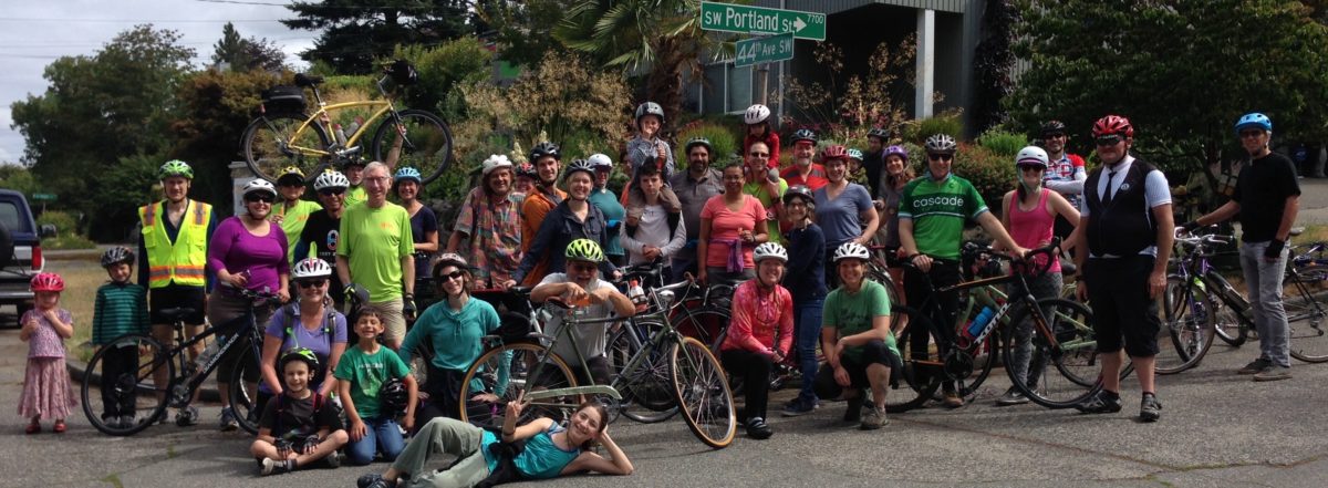
Livable Streets Mayoral Candidates Forum

Eight of the candidates for Seattle mayor will discuss their plans for making Seattle’s streets great places for walking, playing, using transit, shopping, biking, getting to school, and raising a family.

The Livable Streets Candidate Forum is hosted by Seattle Neighborhood Greenways and the Park Shore Retirement Community with support from the Seattle Parks Foundation, Commute Seattle, Sustainable Seattle, Senior Services, Seattle Subway, Feet First, the Bicycle Alliance of Washington, Cascade Bicycle Club, 12th Ave Stewards, Seattle Bike Blog, Futurewise, Capitol Hill EcoDistrict, the Madison Park Community Council, West Seattle Bike Connections, and Bike Works.

Cost/RSVP: Free. RSVP requested. Register online
Transportation: The community center is served by nearby bus routes 8 and 11 and is on the Lake Washington Loop bike route. A by-donation bike valet will be available. There is no off-street car parking.
Childcare will be provided (please register for childcare when you RSVP)

About Seattle Neighborhood Greenways
Formed in August 2011, Seattle Neighborhood Greenways is a rapidly growing volunteer coalition representing many neighborhoods across Seattle to identify, advocate for, and activate safe, equitable, and comfortable streets connecting us to the places we use, whether we walk, drive, ride a bike, push a stroller, or move by wheelchair.

West Seattle Bicycle Counter Installed

UPDATE 6/24/13:  Cascade Bicycle Club has notified us that the the counter was indeed having some counting problems.  They are working on the fix and the bike counter celebration has been re-scheduled to Monday, July 1 from 4 – 6 pm.

West Seattle’s Bike Counter, the second bike counter in the city (the other is at the Fremont Bridge), was unveiled on June 20th.

Photo courtesy of SDOT

Date change: A celebration of the installation will be hosted by the Cascade Bicycle Club Monday, July 1 from  4:00 – 6:00 pm.  Members of the Seattle Department of Transportation and West Seattle Bicycle Connections will also be attending.  Stop by and say “hi!” And be counted.

Funded by Cascade Bicycle Club and the Mark and Susan Torrance Foundation, the counter will provide valuable, regular, up to date bicycle counts for the West Seattle area.

Some  have noticed that there seems to be a quirk in the counting operation; it takes a few moments for a cyclist to be counted, so one can’t see the number “click over” as one rides by, and it seems to jump a few numbers at a time. Fix is in the works.


Highland Park Greenways first public meeting

WSBC members Craig Rankin and Theresa Beaulieu bring this news from Highland Park Action Committee and SDOT.  Craig has been working on this for quite a while in his neighborhood.  SDOT has now funded the public outreach and planning work.

HPAC and SDOT will be hosting a Neighborhood Greenway Meeting that we encourage everyone to come to. If you are at all interested in having a Greenway come through Highland Park, and would like a say in which street the route is on- now’s your chance,  please join us.

It will be on TUESDAY, JULY 9th, from 6-7:30 pm at Highland Park Improvement Club on 12th and Holden.

What’s a Greenway? Neighborhood Greenways are residential streets where signs and pavement markings are used to guide people along the route; and speed and volume management measures discourage cars from avoiding main streets by cutting through on neighborhood streets. These amenities can be especially beneficial for families, children and seniors who might find these routes more comfortable than busier nearby streets. Find out more about them here.
See you then!
Highland Park Action Committee

WSBC July 2 Meeting

July 2, 20136:3o to 8:00 pm

at Highland Park Improvement Club,  1116 SW Holden Street, 98106

map

Special Guest: Sara Zora, SDOT Bike Planner, for discussion of Seattle Bike Master Plan Update.

Other agenda items:  Project reports and volunteer recruiting for projects and activities.6 month Progress report on 2013 action plan.

Open meeting – please come!
 

Let’s be heard: West Seattle in Bike Master Plan

6 pm Wednesday, June 12 at Columbia Branch Librarylet’s go!

Last public open house before the plan is submitted to City Council early this fall.

Tom Fucoloro has a post today in the Seattle Bike Blog featuring kids trying to cross one of our West Seattle arterials as the poster child for the campaign to make our streets safe for walking and biking. He says, “we are failing our kids”.  This lines and  we get on the map in this plan and the policies in it will be the reference document for what should be funded over the next 10-20 years. Let’s help SDOT get it right.

the #50 bus to ST light rail at SODO station (S Lander St) is one way to get there. We’ll have people riding back to WS afterwards if you want company.

Bike Master Plan – Test Questions

Test questions revealed in advance of SDOT’s June open houses!

REPORT CARD     June 2013 Seattle Draft Bicycle Master Plan Update for SW Sector           

This is what we asked SDOT to add to the first draft of the plan update, in December 2012.

(this is not everything in the draft plan — only what we thought was missing last fall.)

How does the June 2013 draft respond? Attend an open house, then let us know!


# Description Notes Grade
1 East Marginal Way S / Alaskan Way S from S Spokane Street to S Atlantic St:  separated cycletrack or off street path     
2 SW Avalon/ Fauntleroy Ave SW, 35th, 36th & 37th Ave SW: intersection and bike lane or cycle track improvements, and add route on 36th Ave SW from SW Avalon to SW Alaska     
3 Connection on East Marginal Way S. from S Spokane Street to Diagonal Way S, Off road path or cycletrack needed on west side of East Marginal Way S.     
4 Fauntleroy to SW Morgan St. via 38th Ave SW: Enhanced street.     
5 Fauntleroy, from SW Alaska to California Ave SW “in-street, major separation”. At least bike lanes both directions of travel.     
6 Greenway route to east of California Ave SW from SW Holgate to Ferry Ave SW via 40th, Walnut SW, 41st SW or 42nd SW.     
7 North Delridge Greenways: add E-W connection at south end of Greenway on 26th Ave SW.  Bike ramp or runnel at steps.     
8 “Brandon Green Super Highway” three new bike/pedestrian staircases or paths along currently unimproved sections of the SW Brandon St. right-of-way: between 16th & 17th SW, between 21st & 23rd SW, and between 30th & 34th SW     
9 SW Portland St:  Extend the Greenway to the East to reach 9th Ave SW (top of SW Highland Park Way)     
10 SW Trenton from 9th Ave SW to 35th Ave SW:  bike lanes or Greenway.     
11 24th Ave SW from SW Cloverdale to SW Thistle: Greenway.     
12 Highland Park Greenway and Westcrest Park trail, and connections into campus of South Seattle Community College, with further Greenway/Trail route to north.     
13 West Marginal Way SW, south of SW Michigan to 2nd Ave SW: Major separation or cycle track.     
14 S Horton Street in SODO from East Marginal Way S to 4th Ave S. – minor in street separation or enhanced street with safe crossing at East Marginal Way S     
15 SW Andover from Delridge SW to 22nd Ave SW: connect 21st Ave Greenway and Delridge Trail from West Seattle Bridge to routes to west via Andover.     
16 37th Ave SW between SW Hudson and SW Alaska: an “enhanced street”     
17 Delridge SW to SW Holden –  Add a trunnel up the stairway.     
18 West Duwamish trail through South Park – coordinate with King County portion to connect with Seattle     
19 Extend the off-street West Marginal trail into South Park along S. Portland St. Cross Holden at the WA-99 light, use WSDOT right-of-way to connect to S Portland St, and add an off-street trail along Portland to 8th Ave S.     
20 Greenway route along Duwamish River in South Park: Connect the West Duwamish trail to the 14th Street Bridge via S Kenyon St, S 10th Ave, and Dallas Ave S.     
21 SW Admiral Way westbound (uphill) from Spokane St/ Avalon/ Harbor Avenue SW:  Improve connection for access to Admiral.     
22 Beach Drive SW into north end of Lincoln Park multi-use path – add connection.    
23 West Marginal Way SW and Highland Park Way SW: Redesign Northwest corner of to avoid collection of dirt and gravel.    


Buses, bikes and social life

This day would have been so much less if I had driven a car the places I needed to go.
This morning a nice tailwind pushed me most of the way to work under threatening skies. Later on I took the #66 to go to the dentist in the U District with bike on board so I could ride back downtown faster than taking the bus. The driver was getting off for a break at the ferry terminal as I approached. I asked if I could load the bike, and he said, “only if you are an architect”. Turned out he was an old friend and fellow architect now driving for Metro part time and running his own flower business. We had a great time catching up on the last 10 years and his various careers and  friends, while he took great care with several disabled passengers who obviously would not be able to drive or bike to their destination. Yaakov also talked about the toll the vibrations from bad paving take on bus drivers, and how we need to fund road improvements.
45 minutes by bus to NE 45th, 30 minutes by bike back to Pioneer Square. Along the way,  Silas from Cascade’s Major Taylor Project introduced himself, as he rode on his way to SeaTac. We talked about that great program and our friends at Cascade and routes through West Seattle to the airport.
Then after work riding home, A.J., SDOT traffic engineer, overtook me me and we chatted about East Marginal and the bike counter and the Delridge Greenway construction, and found out we both had personal connections with Pathfinder School. After he peeled off, a young lady on a IMG_7453super carbon road bike told me about her trip from California where she was just riding her racy machine, and her legs gave proof to it. This would never happen off the bike. Then I finished the ride catching up to and talking with Bob Anderton, bike lawyer and neighbor.
It’s not about the bike.
Don

Seattle Bike Master Plan: Have We Been Heard?

The Bike Master Plan Update final draft will be revealed at public open houses in June. Last fall, we organized and participated in workshops, meetings with SDOT planners, group mapping and online comments.  Does the plan respond?  Lets go find out and let the planners and City Council know what we think!

June 5,  6-7:30 PM   Seattle City Hall:  some of us can attend and check it out.

June 6,  12-1 PM   online session: others can learn and comment

June 12, 6-7:30 PM  Columbia Branch Library:  our chance to give an organized response after exchanging information and thoughts after  the first sessions.   We can organize a group ride and transit options to show the West Seattle flag.

Here is a nice little visual glossary of “bike facilities” planning jargon from the draft plan that can be good preparation for these sessions.

East Marginal Way – with SDOT

Notes from May 17 meeting at Seattle Department of Transportation

Attending from SDOT:

Dongho Chang, City Traffic Engineer

Monica DeWald, Traffic Management Division, Pedestrian & Bicycle Program

Christopher Eaves, Traffic Management Division, Port and Freight


Attending from West Seattle Bike Connections:

Sakaru Tsuchiya, civil engineer specialist in pedestrian and bike facilities

Bob Anderton, attorney at Washington Bike Law

Jeff Hallman, VP of West Seattle Bike Connections, industrial design engineer

Don Brubeck, President of West Seattle Bike Connections, architect


Dongho Chang led the meeting, inviting our input. He noted that SDOT’s concern is to improve safety and legibility of the bike route for the benefit of bike riders and car and truck drivers. SDOT has been out observing conditions, doing traffic counts and talking to other stakeholders over the past two weeks since Lance David’s death in the crash at Hanford on May 1. We used a video from Monica’s bike commute from West Seattle to look at specific conditions.


Mayor McGinn has proposed allocating $700,000 in saving from the Spokane Street Viaduct project to immediate short-term improvements to East Marginal Way and WS Bridge Trail bike facilities, and $200,000 to design for ultimate long-term improvements. The engineering design would be enough to have a project ready to be eligible and competitive for construction funding grants.


This funding requires City Council approval.

We need to let City Council members know that we want this to happen!


Our requests for short-term improvements:

  1. Patch the pavement in bike lanes and at crossings.
  2. Sweep the streets on a frequent basis, due to deteriorated pavement.
  3. Build a safe crossing at Horton or Hanford, efficient for bikes, predictable for drivers.
  4. Fill the large puddles and provide drainage.
  5. Improve the sidewalk on west side to make it a safe, usable pedestrian/bike path. Move fire hydrants, trees between Spokane and Horton, utility poles and signs out of the sidewalk on the west side.
  6. At S Atlantic St/Alaskan Way transition to Portside Trail at Terminal 46:
    1. adjust the aiming of the traffic light video sensor to better detect northbound bikes in bike lane;
    2. add signage or pavement graphic to show northbound bikes where to stop;
    3. change southbound signal to be normally green instead of normally red for southbound ped/bike traffic, with vehicle sensors to change it to red southbound and green east-west or northbound left when needed.
  7. Request Port of Seattle to improve sightlines at terminal entries and exits by making fencing transparent or revising it for better sight triangles at curb cuts.
  8. Promote the improved multi-use path on Spokane St east of East Marginal Way to 6th Ave as option to get into SODO or other destinations to NE.


This funding requires City Council approval.

We need to let City Council members know that we want this to happen!


Long-term:

  1. Physical barrier separating bike from vehicle lanes on East Marginal Way from Spokane to Atlantic, connecting WS Bridge Trail to Portside Trail to Central Waterfront.
  2. Safe crossing at Horton or Hanford for bike traffic to SODO.  Bike detectors, flashing beacons and right-on-red restriction if crossing is on north side of intersection.


We discussed pros and cons of location of separated cycle-track or multi-use path.


  • One-way cycle tracks each side are good for fast riding without bike/pedestrian conflicts, but probably take too much right-of-way width and have challenges with intersections at Hinds, Horton and Hanford.  Deletion of center turn lane is probably not an option due to queuing needs for trucks at terminal entries.


  • A wider two-way multi-use path on the west side from Spokane to Hanford, crossing over to a two-way cycle track on the east side from Hanford to Atlantic would avoid conflict with Port terminal entries. However, it still requires a lane crossover in heavy traffic at Atlantic to get back to Portside trail on the west, so that would still be discouraging for many potential users.


  • A two-way cycle track or wide multi-use path on east would be more “legible” and direct, and avoid the need for crossing East Marginal and making one or two lane cross-overs when going northbound. However, this requires more driveways to cross and has pedestrian conflicts.


Dongho said that the majority opinion so far from various stakeholders is that a separated route all on the west side would be best.  We noted that if that approach is taken, there will still be a need for a safe crossing into SODO and east to Fourth Ave S for some bike riders at Hanford or Horton, and safety on west side will require considerably more width, much better sightlines at terminal entries, and consideration of bike/pedestrian conflicts.


For short-term fixes, Monica noted that the poor soil and pavement conditions mean that any paving patching or overlays are almost immediately destroyed by truck traffic. The long-term plan is to completely repave this road as a heavy truck haul route with much more robust paving, In the meantime, patches and street sweeping can help some. Monica noted that filling for drainage fixes have not worked at the puddles. There is nowhere for the water to go. It just moves the puddles, then the patch deteriorates and it moves back.


Dongho said that they are now looking at a short term multi-use path on the east that would widen the sidewalk by taking planting area and bike lane area, raising it up with ashalt paving and a curb. This would provide the width needed for two-way bike and pedestrian traffic and get bikes up away from the puddles. This could be accomplished within the proposed funding and not require lengthy land negotiations with the Port or BNSF.  This is not yet decided.  SDOT is exploring options and inviting suggestions.


This funding requires City Council approval.

Please let City Council members know that you want this to happen!


Bike to Work Day – Friday May 17

WEST SEATTLE BIKE CONNECTIONS for the first time hosts the F5 Bike to Work Day station at the west end of the West Seattle low level bridge where the Bridge Trail, Duwamish Trail, and Alki Trail converge.

Stop a minute for a home made cookie from our volunteers, coffee donated by Starbucks, a souvenir from Cascade Bicycle Club,  a limited number of WSBC spokecards and Washington Bike Law spokecards, commuting information and friendly conversation. Enter the drawing for Fabulous Prizes! Join Cascade Bicycle Club at a discount.

Alki Bike and Board mechanics will be back again this year offering air for your tires, a quick check of your bike, and maybe a free tube if you are lucky! Say hi to Stu!