SODO Arena EIS – this affects bike connections from West Seattle

Arena Draft EIS came out to no fanfare in August. The proponents’ preferred SODO scheme vacates public streets, and impacts our bike routes from West Seattle to downtown and Beacon Hill, to say nothing of freight traffic and shipping, bus routes and car traffic.  Comments due by September 30.

At first glance, it is predictably and sadly lacking in evaluation of the traffic impact for pedestrians, bikes, cars, trucks, buses, and trains. They  have no b-ball team right now, so this will be easy for the proponents to slip by the citizens of Seattle unless we read it critically and comment or appeal it. If you are interested in a group response, please comment here or send a message. Land use and environmental attorneys wanted!  We need serious analysis and mitigation proposals.

http://buildingconnections.seattle.gov/2013/08/15/seattle-arena-draft-environmental-impact-statement-available/

First public hearing is already past.

Second and final one:  September 19 at 6:00 p.m. Fidalgo Room Seattle Center

Saturday 9/14 – Bikes & Horses

Fiestas Patrias,  South Park

We’ll be there on behalf of Cascade Bicycle Club to do helmet fitting and give helmets to kids who don’t have one, and for bike information. Parade at 11 a.m. We’ll be at the fiesta after the parade, at Sea-Mar Plaza, 9634 Des Moines Memorial Parkway, 1:00 to ~5:00.
IMG_4681
Come volunteer with us, or ride with the Mayor from Seattle Center to the Parade and horse show, then come visit the fiesta. If you want to volunteer, comment or send a message.


This Friday 6:30-8:30 am: Bike & Truck Safety Fair

Share the road safely! Join the Port of Seattle and  partners for an opportunity to learn about truck blind spots and the challenges bicyclists and truck drivers face each day as they share Seattle’s busy roads.

Come for bagels, fruit and coffee. Stay to ride along in a semi on a short course to see what truck drivers can and can’t see. 15 minutes at the Bike & Truck Safety Fair may give you a new perspective, and an opportunity to meet SDOT, WSDOT and Port of Seattle representatives.

When: Friday, September 6, 6:30 a.m. to 8:30 a.m.
Where: Terminal 25, 3225 East Marginal Way, south entry, just north of Spokane Street, where the truck drivers park

Bike_Truck-Fair_Flyer_final_2-1We are partners of this Port of Seattle sponsored event. if you would like to volunteer an hour, we could use one or two more.


East Marginal Way – interim improvements

The West Seattle Blog reported this week on interim improvements for East Marginal Way S from S Spokane St to S Atlantic Street (at the Coast Guard’s Pier 46).

In addition to the improvements listed by SDOT, we have asked for
– removal of fire hydrants that are right in the middle of the path. These violate SDOT, SPU and ADA standards.
– widening of the path/sidewalk to make it safe and usable for high volume 2-way bike and low volume pedestrian traffic, with safe room for passing.
– improvements to sightlines at some of the terminal driveways where fencing, signs or other obstruction interfere with views.

It will be a tough sell to get the bike commuters currently using the northbound bike lane to switch to the sidewalk on the west side unless it is really improved to be a safe, smooth bike path with room to pass safely.

trees in "tree pits" and hydrant obstructions
trees in “tree pits” and hydrant obstructions

trees in "tree pits" and hydrant obstructions
trees in “tree pits” and hydrant obstructions
trees in "tree pits" and hydrant obstructions
trees in “tree pits” and hydrant obstructions
sign could be raised up to avoid obscuring sight triangle at drive.

Bicycle Loop Detectors

WSBC heard that some people don’t know that the Seattle Department of Transportation (SDOT) added bicycle loop detector markings at many intersections. These markings indicate where cyclists should stop in order to trigger a green light at a signalized intersection.

The marks can be seen as one pulls up to a red light, so as long as there are no motor vehicles in front of you. The marker will generally be located behind the white stop line and generally slightly to the right, positioned over the vehicle sensor that’s embedded in the pavement. There are two forms we see most regularly; the older “T” marking or the newer small “bicyclist” marking, seen here.

loopdetectorPortland

Simply make sure your front tire, at least, is centered over this white marker and you should be added to the signal rotation.

loopdetectorbike

Some intersections don’t have this marker, or they may be faded away. If you think a specific intersection should have a marker but doesn’t you can contact walkandbike@seattle.gov and let them know.

Some intersection signal phases are triggered by camera, not a pavement marker, and these are trickier to identify. If you are not picked up when using a loop detector marker, the light skips you on a regular basis, takes an inordinate amount of time to change, or you need more information, you can contact SDOT at the email address above. Reporting signalized intersections that don’t pick up waiting cyclists should be fixed quickly to help prevent impatient red-light running and general cyclist frustration.

Another Collision – Let’s Stop This

Once again, flashing red lights on East Marginal Way. Medic 1, Rescue 1, Ladder 7 and a bike rider on a backboard. This time, bike-on-bike collision. Second one within weeks. Thank you Scott Johnston for this report on Bikewise.org

This was not an “accident”. This was negligence. The one who caused it walked away. The one who was riding correctly in his lane got a trip to Harborview. I hope the injured rider [edited] receives full restitution from the rider who caused the injury, and that the one who caused it is charged with negligent driving and penalized under the new Vulnerable Users law if the injured rider’s injuries are substantial.[end edit]

We need to get to work safely. We need to get home safely. Commuting to work is not a damn race. No one cares how many riders you pass or if you get downtown 2 minutes faster. If you want to race, sign up for a race and stop pretending. Riding to work or home relaxed and alert has all kinds of benefits.

How about trying some of this?

Stay alert.
Be aware of what is in front and beside and behind you. Watch your line. Keep your hands near your brakes.

Ride in a predictable manner.

Share the road.

Leave space between you and others, so you can see what is ahead.

Don’t pass unless you can see well ahead that the way is clear.

Call out your passes before you pass, or ring a bell. When it is crowded or you can’t see ahead, SLOW DOWN and communicate.

DB

West Seattle Bike Connections – Response to Seattle Draft BMP, 2013

Below are excerpts from the “WSBC 2013 BMP Draft Response” sent to the Seattle Department of Transportation (SDOT). The “Report Card” that accompanied the detailed response is posted here. Seattle Bike Blog touched on West Seattle a bit as well.

If you would like a copy of the complete WSBC document, you can request a .pdf copy by emailing: westseattlebikeconnections@gmail.com.

…The BMP itself provides much detail about the framework and how it recommends it be implemented throughout the city via city sector mapping of current/planned bicycle facilities. The facilities found on the included maps contain primarily on/off-street bicycle routing and less information about intersections and bike parking.
WSBC provided feedback specific to bicycle facilities in West Seattle (bike routing, facility types, new facilities proposed to close gaps in the bicycling network, and other comments such as those regarding problematic intersections and terrain fixes like stair runnels) to SDOT during the BMP review meetings in the winter of 2012.
Below is a list of the primary streets/routes/fixes proposed to SDOT followed by an explanation of how the items are treated, or not, on the BMP draft released in June 2013. How the treatment is related to the vision and purpose of the BMP is included if it is of concern…


1) E Marginal Way S / Alaskan Way S from Spokane St to S Atlantic St: Install a separated cycletrack or off-street path.
A cycletrack is proposed and under active review by SDOT, forward of the final BMP review and approval. The review by SDOT and final outcome will be closely monitored by WSBC to make sure the proposal and plans continue to move forward and not be forgotten or de-railed by other projects. This route is an essential, highly traveled bicycle corridor linking West Seattle to the city center and SODO. It is also a busy trucking corridor so safe travel and good facilities are needed to encourage more people of all skill levels to cycle in and out of West Seattle. The Port of Seattle’s desire to rebuild this street as a heavy haul route presents an opportunity to provide the separation of bike and truck traffic that both user groups desire.


5) Fauntleroy Ave SW from California Ave SW to SW Alaska: In-street major separation requested, or at least bike lanes in both directions of travel (N/S).
No changes are proposed to this route by SDOT in the BMP. A disappointing lack for those heading southbound on what is a direct, flat route with little cross-traffic. Sharrows are not enough for inexperienced riders or children heading southbound on this heavily motorized route. We strongly urge reconsideration of this section of Fauntleroy Ave SW.

10) SW Trenton from 9th Ave SW to 35th Ave SW: Bike lanes or Greenway added.
A Greenway is proposed along SW Trenton to 10th, not to 9th. The Greenway doesn’t go directly to 35th Ave SW. Rather, the Greenway route uses 18th to Thistle instead of Trenton. Trenton is more direct – although there’s more traffic – and it also connects to the route west to the Endolyne/Ferry dock to the west more directly and makes a good route east to Delridge/White Center and to Westwood Village. Thistle is less direct in any direction. We request reconsideration of this routing. Is SDOT’s proposed route due to terrain issues or traffic level issues? Should the term “Greenway” be used, or should some other on-street facility be identified instead?


14) S Horton St in SODO from E. Marginal Way S to 4th Ave S: Add minor in-street separation or enhanced street with a safe crossing at E Marginal Way.
Nothing is proposed on the BMP map, a disappointment since this is a good, flat route and not as busy with motorized traffic as the S Hanford St route. Horton is a quiet street that continues all the way to 4th Ave South, unlike adjacent streets. We are concerned that the truck route may have taken options for bike routing off the table, exactly what shouldn’t happen per the BMP draft plan. An addition of a flashing beacon sign marking the bicycle route crossing should be a major consideration at this location, as proposed by SDOT traffic engineers, to provide a safe crossing route into the SODO area for West Seattle residents who work in SODO or travel to the SODO Busway Trail or Sound Transit SODO light rail station.

21) Admiral Way SW westbound (uphill) from Spokane St/Avalon Way SW/Harbor Ave SW: Improve bike route connection access to Admiral. This is a busy intersection, connecting cyclists to routes in/out of West Seattle from four West Seattle areas (Alki, Admiral, Alaska and southern areas and Delridge).
Improved (or any) signage is needed pointing cyclists/pedestrians to stairway (already with a runnel!) just east of the Avalon/Harbor Ave intersection. The stairway is not visible from the intersection.
The bike route crosses Harbor Ave SW/Avalon Way SW at the pedestrian signal. Drivers often neglect to yield to crosswalk users. Crosswalk users (both pedestrians and cyclists) cannot be seen by drivers due to the metal bars installed on the top of the cement barrier bordering westbound SW Spokane St. located to the north of the intersection. In addition, the crosswalk is located just to the north of the intersection, allowing drivers to build up speed before encountering crosswalk. This intersection is not noted on the BMP map but has been identified numerous times to SDOT as a major connector that needs improvement so that many cyclists feel comfortable making a route change.
A cycle track seems to be proposed from Avalon Way SW to Admiral Way SW but it’s not clear how the connection between the two will be made. And with the fairly recently added new bike lanes and Sharrows added to both streets can we really expect to see a cycletrack here instead?

Bike Master Plan Update Comments / Deadline

Deadline for public comments to SDOT is this Friday, July 26.
Seattle Bike Master Plan Update
West Seattle Bike Connections submitted group comments last December. We met twice as a group with SDOT staff, participated in the public workshops, and just submitted detailed comments and a “report card” on the changes made in the June 2013 draft compared with the December 2012 draft.

SDOT bike planners, traffic engineers, and their planning consultants at Alta are working hard to make this a world-class plan for bicycle transportation. We appreciate their good work. But they don’t know every aspect of the city, and that’s where we come in. If you send your own comments on areas important to you, we will give West Seattle a strong voice in this important planning and policy document.

A plan does not guarantee that the planned improvements and programs will be funded, but if something is not included in the plan, it will be much less likely to ever be budgeted by the Mayor, funded by City Council, or implemented by SDOT.

WSBC_2013BMPDraft_ReportCard

121213-WSBC-SDOT-SW-lg

Sunday July 14 West Seattle STP – Seattle to Portland in one Morning

Updated 7/9/13

REASONS TO RIDE WITH US ON STP WEEKEND (Sunday, July 14th):

  1. Didn’t make the 14,000 rider cutoff for Cascade Bicycle Club’s Seattle to Portland ride.
  2. Can’t imagine why anyone would want to ride a bike 200 miles in one or two days.
  3. Have never left the peninsula and see no reason to start now. “We have everything in West Seattle”.
  4. Don’t really know anyone in Portland.
  5. Portland think they all that, but they ain’t.
  6. Like to sleep in own bed instead of on a baseball field in Chehalis, or at least with a good friend with a nice bed and indoor plumbing.

So, COME RIDE West Seattle STP WITH US!

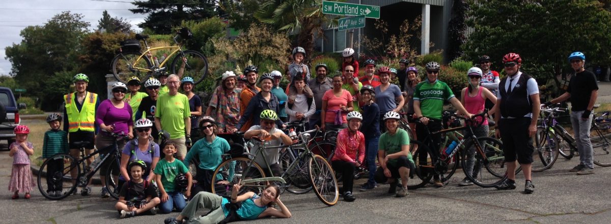
Family friendly West Seattle Bike Connections ride supported by West Seattle Spokespeople and Cascade Bicycle Club.  Ride from Seattle to Portland and back in just 1 morning!

Meet on Sunday (7/14) at 9:45am at Hamilton View Point on California Ave SW to sign in, and be ready to roll at 10:00 on a 9.5 mile easy pace ride via proposed Greenway routes from SW Seattle Street in the Admiral Neighborhood to SW Portland Street in the Fauntlee Crest Neighborhood.

Experienced, certified ride leaders Stu Hennessey and Marge Evans will keep the group together and ride at a social pace. No one left behind. Ride continues on from SW Portland to California and Alaska (the West Seattle Junction, that is) to join the West Seattle Summer Fest. We’ll be at the Greenlife Stage for post ride discussion or routes and bike riding improvements proposed in the Seattle Bike Master Plan update.  Helmets required. This is a Cascade Bicycle Club sponsored ride.

No fee, no t-shirt, no medal, and no bagels with peanut butter, but we stop at a fabulous festival with street food vendors, live bands, arts and crafts!

Riders under 18 years of age must have a parental consent release form, riders under 15 years of age must be accompanied by a parent and riders under 8 years must be on an assisted vehicle, tag along, cargo bike or a bike trailer.

We need volunteers! Please sign up below if you would like to help with this ride. We are looking for some people to act as crossing guards at intersections, making it safe for all ages and abilities to cross.

[iframe src=”https://docs.google.com/forms/d/1-vIWfQuM0MMcL8YNJxIN_5K9goiBndFjR9mnz620bqc/viewform?embedded=true” width=”550″ height=”500″]