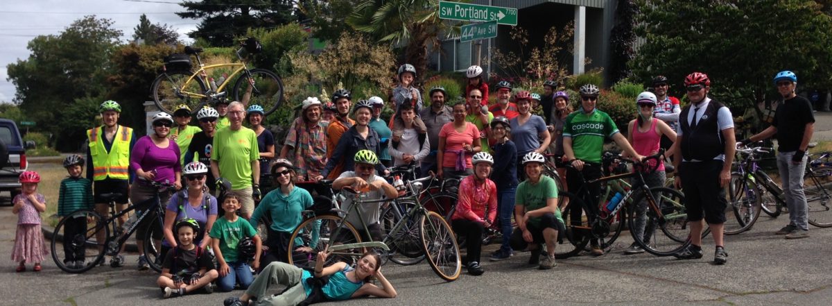
Support the Fauntleroy Boulevard Project

Support the Fauntleroy Boulevard Project – Walk & Talk this week with SDOT. Thursday 3/16 12n and Saturday 12/18 at 10am. Meet at LA Fitness, 3900 SW Alaska.

Seeing the design nearing completion, our members from all over the West Seattle peninsula continue to offer strong support for the Fauntleroy Boulevard Project.

Planned with extensive business and resident involvement over many years, this project will create a welcoming entry to West__ Seattle. The street improvements will make it possible for this rapidly developing urban village to absorb more density without increasing traffic congestion. These street improvements must be made as the one- and two-story commercial strip buildings are being replaced by five- and six-story mixed use buildings. By giving people safe and attractive places to walk, wait for a bus, and ride bikes, more people will use those transportation options instead of driving cars alone.

The project will also make it safe and efficient for people traveling to and through the area by bike, bus and truck. Fauntleroy Way SW is a key through-bike commute route, a transit route, a shopping destination, the auto approach to the West Seattle Bridge, and a Major Truck Street. Separation of bike traffic from heavy vehicle traffic here is vital for our safety. There are good reasons the Bicycle Master Plan calls for protected bike lanes on Fauntleroy

These elements in the design are essential for safety for people on bikes and on foot:

  • One-way protected bike lanes each side.
  • Elimination of the sweeping right-turn pocket lane from south-bound Fauntleroy to west-bound SW Oregon. This is an extremely wide and dangerous intersection for pedestrians and cyclists to cross.
  • Squaring up intersections and reducing crosswalk distances.
  • Distinct differences between bike lane and sidewalk, to reduce pedestrian/bike rider conflicts.
  • Safety island at crossing of Fauntleroy at 36th Ave SW, with attention to control of north-east bound vehicle traffic on Fauntleroy.
  • Bike lane striping through intersections and driveway crossings, with sidewalks at new driveways at sidewalk elevation instead of dipping to roadway elevation.
  • A green bike box at the SE corner of the intersection of SW Alaska & Fauntleroy.
  • Consideration of a pedestrian crossing at 37th, especially if that street may be developed as a neighborhood greenway instead of 36th Ave SW.

And last but not least, we would like to point out that riding bikes is good for local businesses! When we ride, we shop locally. When we ride, we save car parking for others.

Needs more than a yellow sign to make this intersection safe for people on foot, in wheelchairs, on bikes.
Sweeping right highway-style turn is unsafe for pedestrian and bike crossing.

WSBC December 6 meeting at Talerico’s

Please join us to talk about using bikes to get around West Seattle, and celebrate our Ride in the Rain Challenge this month at Talerico’s Pizzeria. Open to all.

6:30 to 8:00 Tuesday, December 6

4718 California Ave SW in the Junction, near SW Alaska St.

Our team of eight was #34 of 454 teams!  Let’s raise a glass and have some pizza and good conversation.

Other topics:  Greenway routes in the 35th Ave SW corridor, and Fauntleroy Boulevard Project resumes design work.


Neighborhood Steet Fund Grant – We got it!

For safety improvements at the intersections of SW Spokane/ Alki Trail/ Harbor Ave SW/ Avalon Way/ SW Manning. Ranked #1 in the city of the 12 projects awarded from the 40 proposals that made it through the District Council voting and SDOT vetting.
Background here and SDOT evaluation here.

DSC02506

Ranked high because the need is so obvious for better crossing safety for people walking and riding bikes. And because under Jodi Connolly’s leadership, with Bill Gobie’s ideas, we worked put together a coalition with Tony Fragada and Alki Community Council, Luna Park Neighbors, Nucor Steel, and got support from David Whiting of Admiral Neighborhood Association and SW District Council, and worked with Luna Park businesses to make sure their needs are included.  Thanks to Dongho Chang, SDOT Chief Traffic Engineer, for coming out to observe conditions and steer us in the right direction.  Thank you to Joe Laubach and all members of the Move Seattle Oversight Committee for supporting this project!

Urbanist article here about all of the projects. Would be great to see more of them funded!

DSC02480

Neighborhood Street Fund Grants come up every three years, for projects in the $100-500K  range. Year 1: selection. Year 2: design. Year 3: construction.

Tues Nov 1 WSBC Monthly Meeting

You are invited to join this open meeting.

6:30 to 8:00 pm at HomeStreet Bank, 42nd Ave SW and SW Alaska Street

Let’s work together to improve conditions and enjoy bike riding in West Seattle. Proposed greenway routes along the central spines of WS are on the agenda, along with World Day of Remembrance, Fauntleroy,…
Screen Shot 2016-10-30 at 9.52.26 AMPrint: “The Politicians” by Jose Guadelupe Posada in 1890, Mexico.

Let’s keep our saints alive and riding este’ dia de los Muertos and election season.

Spokane St Bridge Counts

The bridge goes sideways, and so do the bike counts this year.

Up just 1.8% year to date over last year. June and July were lower, after an amazing Viaduct-closure boost in May. August was up.  Pretty much the same pattern at the Fremont Bridge.

If you or someone you know decided ride in May during the Viaduct closure, and then went back to car or bus:  What made you decide not to continue commuting by bike? Screen Shot 2016-09-05 at 6.42.47 PM

Where is the Fauntleroy Boulevard Project?

Designed, with years of community input.

The next step: SDOT, the Mayor and City Council need to get it funded for construction.

Didn’t happen last year. Let’s let them know we want it in the budget this year! It’s a key element of West Seattle’s development in the “Triangle” east of the West Seattle Junction, and in the Bicycle Master Plan’s citywide routes. It is a major corridor for buses, bikes, trucks, and car traffic going out of West Seattle to downtown to Vashon Island. We need it, to help West Seattle absorb growth gracefully, and enable people in all those new buildings to safely walk, ride bikes and ride buses instead of driving everywhere.

Like, share, meet with us tomorrow to help develop support!

http://www.seattle.gov/transportation/FauntleroyWySWBlvd.htmDSC03671

SW Spokane / Harbor / Avalon Safety

WSBC members Jodi Connolly, Bill Gobie and Don Brubeck met with President of Alki Community Council Tony Fragada and Seattle Chief Traffic Engineer Dongho Chang to look at opportunities to improve visibility and safety at SW Spokane/ Harbor SW/ Alki Trail/ SW Avalon Way intersection.   #1 problem: Coming down Spokane ramp, drivers in low cars turning right cannot see and fail to yield to people on foot or on bikes crossing with the light at crosswalk, due to guardrail and crosswalk locations. This is a main route by bike up to the WS Junction and beyond.

DSC02506


Thank you Dongho and Tony, for spending part of your Sunday afternoon with us!


DSC02472

We are planning to submit a Neighborhood Streets Fund grant application to improve safety and visibility here, working with Alki Community Council, Luna Park merchants, Nucor Steel, and reaching out to North Delridge Neighborhood Council. If you want to improve traffic safety at this intersection and willing to write or go to a meeting of your neighborhood association to put in a good word for this application, March is the time to do it


We are also supporters of a different grant application submitted by Luna Park merchants and neighbors to restore landscaping and make this a nicer entry to West Seattle, recalling local history and making it easier to maintain.  That’s for a small Neighborhood Parks & Streets fund grant.


DSC02480


Delridge-Highland Park Greenway – almost finished?

It was scheduled to be completed in 2015. Now SDOT says January 2016. Seems a bit optimistic from  ground level, and looks like some of it needs reworking to be safe and convenient to use, according to riders who use the route daily.    Here are some photos of a ride on Monday this week mid day, and one from a daily commute in the dark. Click any to enlarge.  But the best way to find out about it is to go walk or ride and decide for yourself. We invite you to give feedback here or to SDOT directly.

SDOT website for the project is here, including maps and drawings.

DSC01856


The good:  lots of new ADA curb ramps on 21st SW at north end. This at SW Genesee, the route to Pathfinder K-8 school, with intersection painted by the community. Speed humps, most old, some new, along this stretch.

DSC01859


The bad and the ugly:   The stretch on 21st Ave SW between 22nd Ave SW and Dumar,  It’s a busy arterial. Really scary with high speed traffic in the dark and wet and a tiny gravel shoulder east side, and rough gravel 4′ sidewalk on west.


DSC01864


The good: a flashing beacon convenient for pedestrians.   Not for bike riders.


DSC01867


hmmm…


Large Pothole on 21st Ave SW Southbound


The bad:  sidewalk only on one side, and only 4 feet wide.  Bike riders use this who want to avoid riding in the arterial traffic without bike lanes or shoulder.

The ugly:  no temporary safety measures during construction while the sidewalk is torn up,


DSC01883


Approaching SW Dumar.

Does this look “safe for all ages and abilities”?


DSC01886


The grand old speed hump and semi-permanent potholes and cones, at Stanislo Elementary School.


DSC01887


Nice new smooth asphalt on SW Myrtle from 21st to 17th. Except for a half block on north side.


DSC01888


Work has not started on the switchback ramp to link two cul-de-sacs on 17th SW


DSC01895


Crossing 16th SW on SW Webster to go from 17th to 15th, then 2 blocks to Kenyon, then back again to 17th!

Would you do this? Would you let your pre-teen use this route instead of crossing at the light at Holden?

No stop sign, no flashing beacon, no traffic signal = no greenway!


DSC01896


On 15th SW.  Work started at curb bulbs at SW Holden.


DSC01903


DSC01899


From 15th & Holden you can see the light at 16th.  Will car drivers stop for people on foot or on bikes or in wheelchairs at 15th?


SDOT ignored WSBC and other community input on route choice, especially regarding the zig zag from 17th on Webster to  15th and then two blocks south crossing Holden on 15th to Kenyon, and two blocks west back to 17th.  Who in their right mind will go 4 blocks out of the way, crossing busy arterials three times without stoplights or even flashing beacons, to avoid crossing at a light at Holden? Prediction: the lumpy narrow sidewalk on 16th will be the route of choice. Should be changed.


DSC01910


Crossing 16th SW again at Kenyon.  Signs and curb ramps. No stop sign or traffic signal, no flashing beacon.


DSC01915


Green stormwater work started by SPU on 17th.


DSC01921


Crossings at the south end of the route between Holden and Roxbury at busy streets are likewise unprotected.

At this point, no curb ramps, no re-aligned stop signs, no traffic calming, no signs.


DSC01925


South end of the route, just short of Roxbury and White Center. No work evident at this end yet.

WSBC Meeting – Tuesday Dec 1

6:30 to 8:00 pm
HomeStreet Bank at WS Junction
41st Ave SW & SW Alaska St
Please come if you can, to plan our next projects and events.
At our last meeting, these rose to the top for 2016. We can do these things only to the extent that we have active participation:
2015-11-23 14.30.04
  • Safe Routes to Schools, and finding ways to get schools engaged in walking and riding to school.
  • Celebration for the work at Chelan 5-way intersection, and monitoring and working for the long term plans there to connect the Alki, WS Bridge and Duwamish trail routes.
  • East Marginal Way S Multi-Modal Corridor planning, to make it a really excellent high-bike-volume corridor to SODO and downtown.
  • Advocacy for more greenway street implementation on the N-S spine of West Seattle from Admiral to Westwood, parallel to California and 35th Avenues, for destinations in West Seattle and for low-stress through routes. [this with Seattle Neighborhood Greenways]
  • Continue events for kids: bike rodeos, mini STP, family rides.
  • Duwamish Trail improvements and completion of missing links.
  • Neighborhood Parks & Streets Fund grants for spot improvements.
  • Engage politically with our new Councilmember whoever she may be; SDOT; neighborhood associations and district councils.
  • Social rides!
We also can really use a dedicated webmaster/social media person, and have other roles to fill. Many things do not require attending evening meetings, so email if you are inspired.