Biking to Bridge the Gap

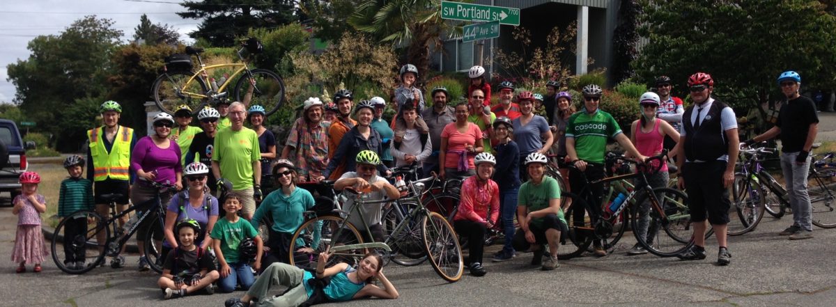
Emily asked us how to ride her bike safely from West Seattle to work at the VA Hospital. Erin asked how to ride to UW Medical Center.  Travis is willing to commute on his new e-bike all the way to Green Lake. We are fielding many inquiries. Bike sales are taking off.  With alternate route traffic delays looming, Georgetown and South Park residents are fearful of gridlock, air pollution, and for the safety of their children walking to school. We know that using bikes instead of cars will help free up capacity on the remaining bridges. But we need a few improvements make it safe and efficient for these folks and many more people to bike instead of drive.

West Seattle Bike Connections with Duwamish Valley Safe Streets, Seattle Neighborhood Greenways and Cascade Bicycle Club sent a detailed proposal to the City yesterday, summarized here.

OUR GOAL

Mobility for West Seattle, SODO and the Duwamish Valley.

Keep people and goods moving safely across much lower-capacity bridges over the Duwamish while the West Seattle High-Rise Bridge is closed. Mitigate impacts on our communities. Honor Seattle’s commitments to equitable transportation, our environment, social justice, and economic vitality.

STRATEGIES

Encourage or incentivize as many people as possible to use bikes or transit, or both, instead of driving private vehicles. Accomplish this before the end of COVID-19 restrictions.

    1. Improve conditions to make it safe, efficient and comfortable for people to ride bikes and transit.
    2. Concentrate on safety and wayfinding for biking and bike/transit connections:
      • On key West Seattle bike routes to the Spokane Street bridge, and from the bridge on East Marginal Way S to Pioneer Square, Downtown, SODO Trail, and SODO light rail station.
      • On bike routes to the 1st Ave S bridge and South Park Bridge, and bike routes within South Park and Georgetown that are impacted by alternate route traffic and may also be needed for biking from West Seattle whenever the Spokane Street Bridge is closed.
      • On routes to and bike parking at the King County Water Taxi dock at Seacrest.
    1. Protect Neighborhood Greenway streets near alternate routes from cut-through traffic, to keep them safe for residents and for walking and biking by people of all ages and abilities.
    2. Ensure availability of bikeshare bikes. Provide bikeshare discounts and bike/e-bike financing to people with low incomes.
    3. Use up to 1% of the bridge repair cost for mitigation measures for bike and pedestrian safety and efficiency.
    4. Use advocacy groups like West Seattle Bike Connections, Duwamish Valley Safe Streets, Cascade Bicycle Club and Seattle Neighborhood Greenways to:
      • Identify opportunities to improve safety and wayfinding.
      • Provide route advice, route maps, bike buddy matching, bike trains and educational rides.
      • Connect people to good advice and local bike shops for selecting and maintaining bikes, including e-bikes.
    • Screenshot 2019-01-05 21.58.42

RECOMMENDED WORK FOR STREET SAFETY

PRESERVE these already planned and funded projects on schedule: 
EXPEDITE these key Bicycle Master Plan high priority routes:
    • Sylvan Way SW / SW Orchard and east to Highland Park
    • Highland Park Way SW off street multi-use path
    • 1st Ave S Bridge to 1st Ave S safe route north from bridge
    • SW Roxbury  bike lanes without reducing traffic lanes
QUICKLY IMPLEMENT spot improvements for wayfinding and safe routes:
    • On Spokane Street Bridge routes at the Chelan 5-way intersection; on Fauntleroy Way and Admiral Way; on the “Nucor Trail” connection from Delridge to the Alki Trail; at Terminal 18 trail crossings on Harbor Island; on East Marginal Way; and on the connections to the SODO light rail station and SODO Trail.
    • On 1st Avenue South Bridge and South Park Bridge routes at the Duwamish Trail “missing link from the Alki Trail; on Highland Park Way at West Marginal Way; at rough rail crossings on the Duwamish Trail and in Georgetown; and on routes in Georgetown through SODO.

WSBC Meeting March 3

Taylor Knowles, SDOT’s Outreach person for the East Marginal Way Corridor Project, will present the 60% design for discussion.  Please join us!

Tuesday, March 3
6:30 to 8:00 pm
Neighborhood House
6400 Sylvan Way SW  (at SW Morgan, in High Point)

We are really excited to see progress on this catalyst project. It is West Seattle’s main bike route to downtown, and the Port of Seattle’s most important “last mile” freight route. This design milestone is a great opportunity for input to dial in the design so it will really work for bike riders and truck drivers.

We and our allies at Northwest Seaport, BNSF, and SODO industries all want a safe route with clear and robust separation of vehicle and bike traffic. The result should be bike riding that is predicable for truck drivers and comfortable for bike riders of all abilities.

If you can’t make the meeting, here’s a link to the project website. One more click takes you to a survey for online input.

Semi-truck tractor with a bike in a rack on the front of the truck.
Some people commute by bike on East Marginal Way to work driving a truck.

East Marginal Way – interim improvements

The West Seattle Blog reported this week on interim improvements for East Marginal Way S from S Spokane St to S Atlantic Street (at the Coast Guard’s Pier 46).

In addition to the improvements listed by SDOT, we have asked for
– removal of fire hydrants that are right in the middle of the path. These violate SDOT, SPU and ADA standards.
– widening of the path/sidewalk to make it safe and usable for high volume 2-way bike and low volume pedestrian traffic, with safe room for passing.
– improvements to sightlines at some of the terminal driveways where fencing, signs or other obstruction interfere with views.

It will be a tough sell to get the bike commuters currently using the northbound bike lane to switch to the sidewalk on the west side unless it is really improved to be a safe, smooth bike path with room to pass safely.

trees in "tree pits" and hydrant obstructions
trees in “tree pits” and hydrant obstructions

trees in "tree pits" and hydrant obstructions
trees in “tree pits” and hydrant obstructions
trees in "tree pits" and hydrant obstructions
trees in “tree pits” and hydrant obstructions
sign could be raised up to avoid obscuring sight triangle at drive.

East Marginal Way – with SDOT

Notes from May 17 meeting at Seattle Department of Transportation

Attending from SDOT:

Dongho Chang, City Traffic Engineer

Monica DeWald, Traffic Management Division, Pedestrian & Bicycle Program

Christopher Eaves, Traffic Management Division, Port and Freight


Attending from West Seattle Bike Connections:

Sakaru Tsuchiya, civil engineer specialist in pedestrian and bike facilities

Bob Anderton, attorney at Washington Bike Law

Jeff Hallman, VP of West Seattle Bike Connections, industrial design engineer

Don Brubeck, President of West Seattle Bike Connections, architect


Dongho Chang led the meeting, inviting our input. He noted that SDOT’s concern is to improve safety and legibility of the bike route for the benefit of bike riders and car and truck drivers. SDOT has been out observing conditions, doing traffic counts and talking to other stakeholders over the past two weeks since Lance David’s death in the crash at Hanford on May 1. We used a video from Monica’s bike commute from West Seattle to look at specific conditions.


Mayor McGinn has proposed allocating $700,000 in saving from the Spokane Street Viaduct project to immediate short-term improvements to East Marginal Way and WS Bridge Trail bike facilities, and $200,000 to design for ultimate long-term improvements. The engineering design would be enough to have a project ready to be eligible and competitive for construction funding grants.


This funding requires City Council approval.

We need to let City Council members know that we want this to happen!


Our requests for short-term improvements:

  1. Patch the pavement in bike lanes and at crossings.
  2. Sweep the streets on a frequent basis, due to deteriorated pavement.
  3. Build a safe crossing at Horton or Hanford, efficient for bikes, predictable for drivers.
  4. Fill the large puddles and provide drainage.
  5. Improve the sidewalk on west side to make it a safe, usable pedestrian/bike path. Move fire hydrants, trees between Spokane and Horton, utility poles and signs out of the sidewalk on the west side.
  6. At S Atlantic St/Alaskan Way transition to Portside Trail at Terminal 46:
    1. adjust the aiming of the traffic light video sensor to better detect northbound bikes in bike lane;
    2. add signage or pavement graphic to show northbound bikes where to stop;
    3. change southbound signal to be normally green instead of normally red for southbound ped/bike traffic, with vehicle sensors to change it to red southbound and green east-west or northbound left when needed.
  7. Request Port of Seattle to improve sightlines at terminal entries and exits by making fencing transparent or revising it for better sight triangles at curb cuts.
  8. Promote the improved multi-use path on Spokane St east of East Marginal Way to 6th Ave as option to get into SODO or other destinations to NE.


This funding requires City Council approval.

We need to let City Council members know that we want this to happen!


Long-term:

  1. Physical barrier separating bike from vehicle lanes on East Marginal Way from Spokane to Atlantic, connecting WS Bridge Trail to Portside Trail to Central Waterfront.
  2. Safe crossing at Horton or Hanford for bike traffic to SODO.  Bike detectors, flashing beacons and right-on-red restriction if crossing is on north side of intersection.


We discussed pros and cons of location of separated cycle-track or multi-use path.


  • One-way cycle tracks each side are good for fast riding without bike/pedestrian conflicts, but probably take too much right-of-way width and have challenges with intersections at Hinds, Horton and Hanford.  Deletion of center turn lane is probably not an option due to queuing needs for trucks at terminal entries.


  • A wider two-way multi-use path on the west side from Spokane to Hanford, crossing over to a two-way cycle track on the east side from Hanford to Atlantic would avoid conflict with Port terminal entries. However, it still requires a lane crossover in heavy traffic at Atlantic to get back to Portside trail on the west, so that would still be discouraging for many potential users.


  • A two-way cycle track or wide multi-use path on east would be more “legible” and direct, and avoid the need for crossing East Marginal and making one or two lane cross-overs when going northbound. However, this requires more driveways to cross and has pedestrian conflicts.


Dongho said that the majority opinion so far from various stakeholders is that a separated route all on the west side would be best.  We noted that if that approach is taken, there will still be a need for a safe crossing into SODO and east to Fourth Ave S for some bike riders at Hanford or Horton, and safety on west side will require considerably more width, much better sightlines at terminal entries, and consideration of bike/pedestrian conflicts.


For short-term fixes, Monica noted that the poor soil and pavement conditions mean that any paving patching or overlays are almost immediately destroyed by truck traffic. The long-term plan is to completely repave this road as a heavy truck haul route with much more robust paving, In the meantime, patches and street sweeping can help some. Monica noted that filling for drainage fixes have not worked at the puddles. There is nowhere for the water to go. It just moves the puddles, then the patch deteriorates and it moves back.


Dongho said that they are now looking at a short term multi-use path on the east that would widen the sidewalk by taking planting area and bike lane area, raising it up with ashalt paving and a curb. This would provide the width needed for two-way bike and pedestrian traffic and get bikes up away from the puddles. This could be accomplished within the proposed funding and not require lengthy land negotiations with the Port or BNSF.  This is not yet decided.  SDOT is exploring options and inviting suggestions.


This funding requires City Council approval.

Please let City Council members know that you want this to happen!


Freight Advisory Board Meeting Notes

April 16, 2013
EAST MARGINAL WAY
Peter Hahn, SDOT Director, updated the board on issues concerning freight movement. Some of them also concern bike movement. One is East Marginal Way, which he and Christine Wolf, Port of Seattle Seaport Transportation Director, described as the #1 priority for improvement. The “poster child”. The Port wants haul routes redone to support heavier truck loads to make ship-to-rail transfers efficient and competitive with the ports in Long Beach and elsewhere. East Marginal Way is the next big step, along with the current flyover ramp at Altantic and the upcoming underpass at SR99 on the truck haul route to the Argo rail yard. The Sonics Arena project Memorandum of Understanding commits $40M to freight mobility, which could be spent on East Marginal Way. What does it mean for bike transportation in West Seattle? Improvements to East Marginal, along with the 5way intersection at Chelan, are the keys to the city. Improving that road will make it safe and easy for thousands more to commute by bike instead of car to downtown. This will get cars out of the way of bikes and buses. Use of currently illegal 98 ton super-chassis rigs increases safety risks for all road users. If we can work with the Port and SDOT and WSDOT to get a cycle track on East Marginal as part of this rebuild, it will be a win for everyone in our community, including truckers, shippers, bus riders, car drivers and all of us who depend on a thriving Port of Seattle and international trade for our livelihood.

IMG_2253

CARMAGGEDON, THE SEQUEL
When the tunnel boring machine is going under SR99 this September or October, the highway will be closed to traffic, just in case it should collapse. We can help mitigate this problem if we can get more people onto bikes to ride downtown or to the water taxi. Let’s help show people what we can do to reduce traffic congestion!

SDOT is about to start an Industrial Area Freight Access Project study that is part of development of the Freight Master Plan. The FMP will follow the Bike Master Plan currently under way, and the completed Pedestrian Master Plan.

WE COVER THE WATERFRONT
Steve Pearce and Mike Johnson of SDOT presented the mid-way design concept for the Central Waterfront. This gets plenty of coverage elsewhere, so I’ll just mention that the preferred bike route alternative, for safety and separation of pedestrians and bike riders, is a two-way cycle track on the west side of Alaskan Way, separated from both the pedestrian promenade and the vehicle lanes.

Preferred by all stakeholders including the freight board members at this meeting. Pier service entries will be mid block driveways, for right-turn-in and right-turn-out only, as most are now. This has the advantage of narrower curb cuts and slower speeds than straight-in crossings at intersections, and works better with the pier layouts, but has the disadvantage of poor visibility for truck drivers on their right side.

The cycle track will have curves, markings and raised paving at crossings to alert riders to watch for pedestrians and vehicles, and will be designed with attention to sightlines for vehicles, pedestrians and cyclists. This option seemed like it would serve the widest range of riders and be least likely to be taken over by wandering tourists. I say this after navigating dozens of dogs, skaters, runners, strollers and oblivious ice-cream cone consumers in the separated bike path instead of the pedestrian walkway on the Alki Trail this afternoon.

Don Brubeck