Bridge bike counts up!

June2015 bridge countBike count on Spokane St Bridge in June was up 13% over June 2014, and up 12.4% for the year to date over same period last year.
It is also obvious from daily data that a lot of people skipped work on Fridays! Or took 1st Ave Bridge home, or car or bus. Click link at top right of our home page to see.

SDOT data, our graph.

Yes SDOT – Make Admiral Way Safe

We support the Admiral Way Safety Project .

Several of our members live on the west slope of Admiral Way SW. We share the concerns of our neighbors for the safety of our parked cars. But we are more concerned about the lives and personal safety of the people who walk and ride bikes everyday in danger from speeding vehicles.

2015-05-28 19.48.06


We want to see the SDOT plan implemented.

The primary objective is to slow down speeding car traffic, for the safety of all users of the street, including people riding bikes, people walking across to or from their bus stop or car, and kids and parents walking to the beach and to schools and playgrounds at Alki Elementary and Madison Middle School.

Loss of free on-street car parking is a concern for people on a few blocks of Admiral. It is due to people parking across the street to protect their cars from being hit by drivers who lose control on the curves below Schmitz Park. The posted limit is 30 mph, with a warning sign to slow to 20 mph on that curve, but due to the very wide lanes, many drivers are going 40 mph.  On days like Saturday when the Pirates came ashore, visitors to Alki were parked all the way to Schmitz Park Bridge.  But on Sunday, just as nice a day, there was plenty of open parking on street from 60th SW up the hill.  The crowded days here are like normal days for parking a car on Capitol Hill or lower Queen Anne.

2015-05-28 19.41.07

Adding bike lanes is a way to narrow the general purpose lanes and center turn lanes to minimum 11 and 10 foot widths. To get the bike lanes wide enough to be safe from door zone danger, a parking lane has to be subtracted to fit the available roadway width.  With houses fronting on only one side of the street most of the way along the hill, this should not be too much of a problem.  If the speeds are actually reduced, then people will not be so hesitant to park in front of their houses on the north side.  It should be a win for everyone.  However, if it does not work out that way, this is just paint.  It can be adjusted easily.

2015-05-28 19.35.11Some commenters have embraced greenways parallel to Admiral as the solution to go from Alki to California Ave SW. They are not looking at the map or trying it. Admiral is at an angle most of its length. There are no streets parallel to Admiral. There are no east-west streets that actually go through from Alki to Admiral Junction because of the steep slopes. It’s a beach bluff and a glacial moraine ridge beyond.

2015-05-28 19.47.45
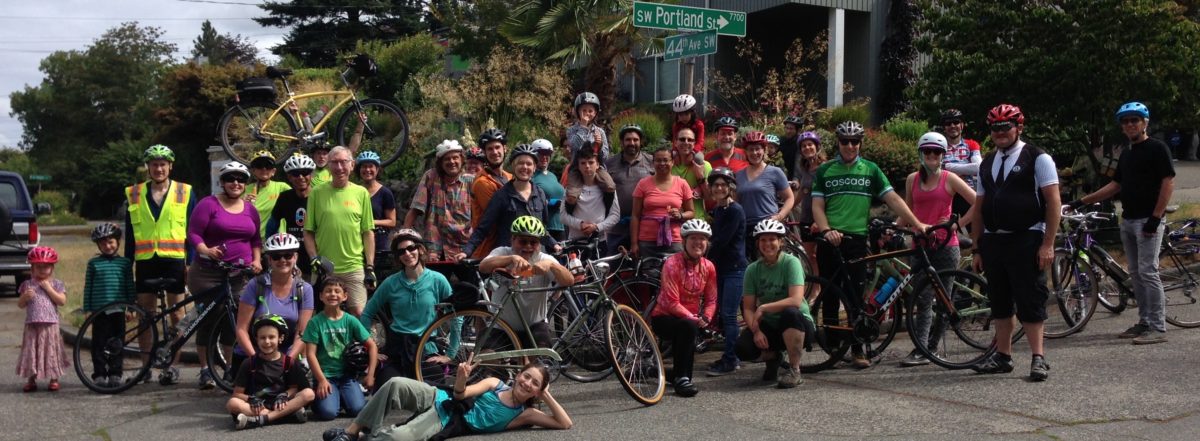
Admiral is at an angle because it provided an easier slope for a truck hauling route, and that’s why it works for bike riders, too, and that’s why it is included in the Seattle Bicycle Master Plan 2014 update map as a bike route with  “In Street Minor Separation” – bike lanes.  The west slope of Admiral Way has steady bike traffic, but lot’s more would use it if there were bike lanes and slower traffic speeds.


Bike Rodeo at the Junction

From our bike rodeo May 30 at KEXP’s Hood-to-Hood Block Party at the Junction. Young riders gained confidence and riding skills, while having fun and earning prizes.  It was a Friday school and work day, without advance mention in KEXP’DSC08864 DSC08869 DSC08870 DSC08900 DSC08904 DSC08915 DSC08920s announcements, so most of our participants were 2 to 4 years old, on balance bikes provided by West Seattle Cyclery. with a flurry of olde kids after school. SPD bike patrol officers showed everybody how to ride it, and got the grownups into it, too.

Thanks for the invitation and support from Susan Melrose of the West Seattle Junction Association and Brad Loetel at West Seattle Cyclery.  Clarrisa Allen and Ed Ewing at Cascade Bicycle Club supplemented our rodeo props and literature,  and WSBC volunteers Kathy Dunn, Bob Winship, Jeff Hallman, and Don Brubeck were the bike rider wranglers and crew.

Arena final EIS – SDOT/DPD responses

The Final Environmental Impact Statement (FEIS) for the proposed basketball/hockey arena in SODO has been published.  We commented –  major impacts to traffic that would affect travel by bike from West Seattle, and use of bikes to get to the Arena were not really considered in the draft EIS.  SDOT/DPD responses to our comment letter are attached.   Links to the entire FEIS are online at DPD’s website here. IMG_1356

Arena FEIS-WSBCltr_Page_1


Arena FEIS-WSBCltr_Page_5

Arena FEIS-WSBCltr_Page_2Arena FEIS-WSBCltr_Page_3 Arena FEIS-WSBCltr_Page_4 Arena FEIS-WSBCltr_Page_5

The comment letters and responses are in Appendix F.


Bike to Work Day – Friday 5/16

Bike to Work Day is this Friday, May 15. Stop by our Commute Station under the West Seattle Bridge, open 6:00 to 9:00 am.

Bike mechanics from DIY Bikes. Home made cookies, fresh fruit, hot coffee, Cascade swag, other treats, and information about the Chelan 5-way intersections proposals.

If you can be there at 8:15, join a group ride to the BTW Day rally at Union Station.

If you go up Second Ave, you can stop at Washington Bike Law’s commute station at Cherry Street for fun and games.

Fauntleroy Boulevard Project – move it into Move Seattle

DSC03671

One of our top priorities is missing in action from the Move Seattle levy package: The Fauntleroy Boulevard Project. It’s in the Seattle Bicycle Master Plan. It’s already almost 100% designed.  If not in this levy, chances are that it won’t be built before 2025, after piecemeal construction of the whole rapidly developing triangle area east of the West Seattle Junction.

Call to Action:
·         Write to the Mayor and SDOT Director Scott Kubly.
o   Mayor Murray Contact Form
o   SDOT Director Scott Kubly E-mail: scott.kubly@seattle.gov
·         Contact the Mayor and SDOT via social media.
o   Mayor Murray Twitter: @MayorEdMurray
o   SDOT Twitter: @seattledot
o   Mayor Murray Facebook
o   SDOT Facebook
·         Take the SDOT Move Seattle Online Survey.
o   Make sure to talk about the Fauntleroy Way SW Boulevard Project when the survey asks: “Are there other transportation investments you feel should be a top priority for funding through this levy?”

Fauntleroy Way SW serves many purposes; it is a key entrance to West Seattle, a designated freight and bicycle route, and is home to numerous retail businesses and new residential developments, with many more on the way in the next few years. However, the portion of Fauntleroy Way from 35th Ave SW to SW Alaska St has poorly defined sidewalks, significant distances between marked pedestrian crossings, no dedicated space for bike riders, and minimal landscaping. Through several extensive community processes, the residents and business owners in the area have expressed the need for improvements to make this stretch of Fauntleroy Way SW safer for pedestrians and bikes, and highlight its role as a main entrance to West Seattle.

The Fauntleroy Way SW Boulevard Project would include a raised median, 6-foot wide sidewalks, protected bike lanes, street lighting and other safety improvements between 35th Ave SW and SW Alaska St. Discussions of improvements to Fauntleroy Way began in 1999, when the West Seattle Junction Hub Neighborhood Plan identified streetscape improvements in this area, and continued through the multi-year West Seattle Triangle planning process. The streetscape plan was formally adopted by SDOT and the Seattle Department of Planning and Development in 2012. In addition, the 2014 Bike Master Plan designated Fauntleroy Way SW for a protected bike lane.

The new Water Taxis will rust your bike

Support your local bike shop: Ride the M/V Sally Fox to Vashon Island, or the new one coming to the West Seattle Route.

Or, contact these officials to ask for in-cabin bike racks like the old water taxis, or covered on-deck storage that excludes salt spray:

paul.brodeur@kingcounty.gov,
harold.taniguchi@kingcounty.gov,
Dow.Constantine@kingcounty.gov,
joe.mcdermott@kingcounty.gov

Here is what all four bike shops in West Seattle and White Center, and the closest to the water taxi terminal downtown, have to say:

150421 water taxis bike shops


PRO safety petition for 35th Ave SW

If you are FOR safety on 35th Avenue SW, please sign this PRO-safety petition.
You may have seen a petition circulating to STOP the safety improvements planned for “I-35”. There a several hundred signers who may be deceived by the petition claims that 35th is safe as is, and speed is needed, or actually saves time. It is hard to believe that they would be more willing to risk their neigbors’ lives rather than lose a few seconds of car travel time due to 5 mph lower speed limit; a signal at Graham; a greenway on 34th; pedestrian safety islands; a left turn lane to avoid rear-ending and left-hook car crashes.

If you are FOR Safety, please sign this PRO-safety petition, signed by over 600 concerned neighbors in 2014, and re-opened now.

Please keep the boxes clicked so that Seattle Neighborhood Greenways / West Seattle Greenways can notify you of victories in this project.DSC00064

WSBC meeting Tuesday April 7

Open meeting – you are invited to come plan activities, and discuss everything related to using bikes in West Seattle.

6:30 to 8:00 pm at HomeStreet Bank,  41st Ave SW at SW Alaska St    thank you HomeStreet Bank!

Agenda includes

  • bike parking on the new water taxis , with Ken Pritchard from Vashon
  • Bike Month activities including our commute station and a bike commuting workshop
  • USDOT Safety event May 7
  • Denny-Lincoln Classic ride
  • 35th Ave Safety Corridor Project and Chelan 5-Way Intersection project
  • Bicycle Master Plan 5-year work plan update
  • rides, rides, rides:  Garage Sale Day ride, Park & Art Ride,  West Seattle STP, Spoke & Food Ride
  • grants, grants, grants for intersection improvements
at the fishing pier on the West Seattle Bridge trail. photo by Kathy Dunn


Delridge at the bridge

Delridge-alextutu1821

Delridge path work in full swing near WS Bridge. Detour route on 23rd SW to/from SW Andover. Ignore the sign on 23rd at Andover that says “road closed” – it is open for bikes to the trail. Photo by Alex, who posts on WS Blog Flickr group as alextutu1821.