WSBC Meeting Tues Dec 2

Monthly meeting, Tuesday December 2

6:30 to 8:00 pm

Homestreet Bank,  SW Alaska St at 41st Ave SW

Open meeting – you are invited and welcome to plan activities and meet others who are working to make it easy and safe to use a bike to get around West Seattle and beyond.

We need volunteers for:

  • advocacy to city agencies
  • participation and presentations for neighborhood associations;
  • writing stories;
  • taking pictures;
  • making maps;
  • graphic design;
  • grant applications for street and trail improvements;
  • representing us with our partners at Seattle Neighborhood Greenways and Sustainable West Seattle;
  • setting organizational tools and accounts,
  • leading or volunteering at events like Alki Summer Streets and Fiestas Patrias;
  • baking cookies for Bike to Work day;
  • working with businesses and schools on bike parking and safe routes to school and Bike Month;
  • helping organize new Greenways groups;
  • welcoming and following up with people who “join us” or “like” us online;
  • organizing or leading social rides around West Seattle;
  • organizing or working at DIY trail maintenance projects;

All these are potential meeting topics, but even if you can’t make an evening meeting, you can offer to volunteer in something that interests you, by email to us directly at westseattlebikeconnections@gmail.com

Justice for Jake, and Death on Delridge

DSC04402A driver convicted and awaiting sentencing for a road rage against one of our local heroes. Jake Vanderplas, community leader and initiator with Stu Hennessey of the North Delridge greenways, is a model for calm, responsible riding. Hard to believe that he could have triggered the assault by the driver, who is now awaiting sentencing. Good to see that the courts are taking this kind of crime more seriously.

Meanwhile, same day, another person walking across a street at an intersection was killed by someone driving a car. On Delridge this time. Traffic in the other lane was stopped for the pedestrian. This street has a 35 mph speed limit. The survival rate at that speed is a small fraction of what it is if speeds are reduced to 25 mph.

We need drivers to slow down and pay attention! We all need to walk, ride, and drive with patience and care for each other.

Thank you to West Seattle Blog for the reporting and the community conversations.

1385066_10101598130445843_7321267305444518168_n


Thurs Nov 13 Tweed Ride – WS Bridge to Proletariat

Dress in your warmest, tweediest, and join us for a social ride, food and drink!

Meet at precisely 5:30 p.m. under the West Seattle Bridge where the trails meet, and ride to White Center.

WSBC Tweed Ride 11-13-2014

SXSW

South Seattle – Can you get there from West Seattle?

Yes, but it may not be for everyone. Could be lot better. Here is a start at some maps of routes.

Easy grades and fairly quiet streets are possible if you go all the way to the International District and double back on 12th S. Thanks to Stu Hennessey for this West Seattle Spokespeople ride route.

A quicker but steeper connection to Mountain to Sound Greenway and Beacon Ave is via busway trail and Holgate, but it’s better westbound. Eastbound involves poor access to a stair carry and sidewalk to get up the Holgate viaduct over I-5.

Via Georgetown is possible a few ways: 1st Ave S Bridge from West Duwamish Trail, or 1st Ave S viaduct from Spokane St Bridge.
There is also the newly re-opened South Park Bridge, via the West Duwamish Trail and route through South Park, but not sure about bike friendly routes on east side. Anybody familiar?

And you can continue south from South Park on busy 14th Ave S, then along a really crappy little trail/mudpatch by the Machinists union to West MargiSW-S Seattle 8 WS Junction-Beacon Ave 8 Alki-Col City bike routenal Place to get to a little ped/bike bridge over the Duwamish at Cecil Moses Park and the East Wind Fish Weir site, and then south on the Green River Trail at S 112th St.

http://www.gmap-pedometer.com/?r=6475498
http://www.gmap-pedometer.com/?r=6475820
http://www.gmap-pedometer.com/?r=6475817

Fauntleroy Blvd Project – please contact Council now

Council Member Rasmussen is proposing to add construction funding to next year’s budget for the Fauntleroy Boulevard project. It includes key bike and road safety improvements, and is funded through design but not for construction. Will you help by emailing City Council memDSC03671bers to boost support? Needed by end of day Wednesday.

http://www.seattle.gov/transportation/FauntleroyWySWBlvd.htm

http://www.seattle.gov/council/councilcontact.htm

Sally Bagshaw
206-684-8801
sally.bagshaw@seattle.gov

Mike O’Brien
206-684-8800
mike.obrien@seattle.gov

Sally Clark
206-684-8802
sally.clark@seattle.gov

Ask support for:
Budget Action Title: Add $13 million for construction of the Fauntleroy Way SW Improvement CIP project, amend C.B. 118238 (LTGO Bond Ordinance),

Talking points, (or even better, say what it means to you personally):
It is a major arterial with transit and truck through a developing urban center with lots of apartments and little parking.
Bike and pedestrian improvements will make it more possible for people to live without driving so much, and will let West Seattle absorb growth without this becoming a choke point.
It will make it a safe and welcoming entry to West Seattle from the freeway.
It has been in the neighborhood plan for over 15 years, and it’s in the Bicycle Master Plan.
A lot has been invested in design. Now it’s time to implement and make good on that investment.

Background (and you don’t need all this in your message):

Fauntleroy Way serves many purposes; it is a key entrance to West Seattle, a designated freight and bicycle route, and is home to numerous retail businesses and new residential developments. However, this portion of Fauntleroy Way has poorly defined sidewalks, significant distances between marked pedestrian crossings, no dedicated space for bike riders, and minimal landscaping.

The Fauntleroy Way SW Improvement Project builds upon previous planning work done by the community. Discussions of improvements to Fauntleroy Way began in 1999, when the West Seattle Junction Hub Neighborhood Plan identified streetscape improvements in this area, and continued through the multi-year West Seattle Triangle planning process. The streetscape plan was formally adopted by SDOT and the Seattle Department of Planning and Development in 2012. In addition, the 2014 Bike Master Plan designated Fauntleroy Way SW for a protected bike lane.

Through several extensive community processes, the residents and business owners in the area have expressed the need for improvements to make this stretch of Fauntleroy Way SW safer for pedestrians and bikes, and highlight its role as a main entrance to West Seattle.

The project design includes a raised median, 6-foot wide sidewalks, protected bike lanes, street lighting and other safety improvements between 35th Ave SW and SW Alaska St. Last year, Council added $1.3M to continue design work on this project in the 2014 Adopted Budget, and the project is now at 60% design.

The 2015 Proposed Budget includes $500,000 to complete 100% design on the project by 2Q 2015, but it does not include construction funding. The current construction cost estimate for the project is approximately $13M, based on the 60% design. The beginning of construction by 2015 would be 16 years after the adoption of the Neighborhood Plan first identifying the need for improvements in this area.

Vigil Walk for Zeytuna – Columbia City

Some of us participated in a walk and meeting today for second grader Zeytuna Edo, still hospitalized over a month after a hit and run driver hit her in the marked, signalized crosswalk at S Genesee and MLK. We were there supporting her family and neighbors, with Rainier Valley Greenways, Seattle Neighborhood Greenways, Mayor Murray, Councilmember Harrell, Anthony Auriemma, SDOT Director Scott Kubly, Bikeworks, and members of other groups advocating for safe streets. This intersection has lights, crosswalks, safety islands. The community expressed demands for  lower speeds, police enforcement, and drivers who will focus their attention on driving and take responsibility for their actions. DSC05326 DSC05320 DSC05301 DSC05304

35th Ave SW Safety Corridor – time for input

One car crash every 3.4 days for the past 10 years. 40% of the crashes include injuries, many to people trying to cross on foot or on bikes, and five fatalities.

Initial public input meeting on 35th Avenue SW Safety Corridor Project last night: Well attended, well moderated by Jim Curtin, SDOT project manager, who lives on the corridor.
See the WS Blog today for a full illustrated report including the city’s slides.

Send your ideas, comments, questions to jim.curtin@seattle.gov.

Repeat of this input meeting:  Tuesday, October 28th, 3:30-5 pm at Southwest Branch Library on 35th at SW Henderson

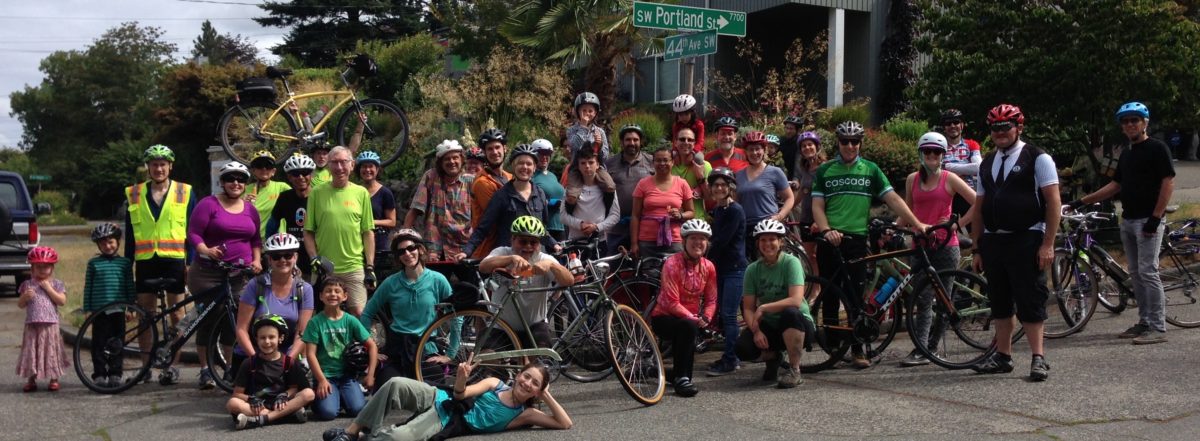
It was good to see Kathy Dunn, Sakaru Tsuchiya, Aaron Goss, Joe Szilagyi, Amanda Helmick, Chas Redmond and Cathy Tuttle of Seattle Neighborhood Greenways at the meeting.

Here are some comments from Joe, who lives just off 35th in High Point and rides with his young daughter on board:

“35th ave SW is very dangerous road to bike on.  In fact, it is the only street in West Seattle that I will not bike even one block.  Cars drive very fast and there is no bike lane.  No sharrows.  No safe place to ride.  I am constantly seeing smashed parked cars by the side of the road.

“That being said – 35th Ave SW is bordered by very low volume streets that are a joy to bike on.  For example, if you want to bike from Highpoint to Westwood, you can take 30th or 31st and have a pleasant and safe ride.  We do it all the time.  As much as I’d love for every street to be bike friendly, I wonder if that’s a reasonable goal for 35th.  My thought is let the cars stay on 35th and that way the bikes are able to safely use the side roads.

“Now… pedestrians and bikes will need to cross 35th.  So there are improvements that need to be made.  And 35th needs to be made safer for motorists as well.  So I applaud and support the efforts to make 35th safer.  I just don’t see making 35th ave SW biker friendly as a reasonable goal given the excessive volume of cars.  But I trust the WSBC leadership.  So I’ll be behind whatever approach the group thinks is the best for the community.”

from Don:
We can follow the lead of the Central Area group that is getting greenways built parallel to 23rd Ave before the re-do of 23rd. It helps prevent those quiet residential streets from becoming a short cut for car traffic, and provides a safe place to walk and ride while the road construction happens, and forever after for those who don’t want to ride on busy arterials.

I rode from downtown Tuesday night to my granddaughter’s birthday party in Arbor Heights west of 35th. From Avalon, I rode 36th/37th going there. It’s got some big uphills going south, but it works. Going home I took 34th all the way to Graham, used the sidewalk from Graham to the library, crossed there to 36th, and went back to Alaska on 36th/37th, then over to Alki.  Very pleasant and direct at night. 34th is not as hilly as 36th/37th. 34th is a great connector for three schools, HP Library, HP Community Center, churches,  parks, etc.

Wednesday, i rode from downtown and WS Bridge trail onto the Delridge sidewalk, then down to 26th Ave Greenway, then west to 30th, up the hill (walking my heavy bike up the really steep block of Snake Hill) and up through High Point to Neighborhood House.  Went back on Morgan to 34th and the same way as previous night.  That’s three good routes parallel to 35th that already work really well, and would be better if they had greenway treatment and signals at busy street crossings for rush hour crossing.

Aaron Goss (Aaron’s Bike Repair) was at the meeting. He commutes daily along 35th by bike and is obviously experienced. He likes it because 35th is less hilly, and wants bike lanes and center turn lanes and one regular traffic lane each way.

There’s a repeat of this input meeting next week.3:30-5 pm at Southwest Branch Library on 35th at SW Henderson

Greenways: Tell SDOT What You Think

Delridge Greenway at 26th & Genesee (image from Google Streetview)

Have you biked, walked, or driven (gasp!) on one of the designated Greenways around Seattle?  Do you know there’s an existing Greenway in West Seattle that connects Delridge to Highland Park along 26th Ave SW?

There is a plan to build a network of 250 miles of neighborhood greenways in 20 years.  If you have feedback about Greenways, SDOT would like to know. Please take the time to respond to the survey they have available:

http://www.surveymonkey.com/s/greenwaysevaluation

You have until October 10th to voice your opinion!

We certainly want to see more Greenways and safe streets in West Seattle, and hope you do too.

PARK(ing) Day – fun and games

PARK(ing) Day at the West Seattle Junction – fun and games and bike blender smoothies with fresh fruit and Husky Deli ice cream!

PARK(ing) Day happens once a year, on the thiDSC04598rd Friday in September, and is an opportunity for any Seattleite to temporarily turn parking spaces into public places. The event raises awareness about the importance of a walkable, livable, healthy city and helps people re-think how our streets can be used. Ours was one of two parklets in West Seattle, and 50 city-wide.

Thanks to Jeff Hallman for the bike blender cargo bike, Mike Oxman for all the trees and plants, Huky Deli and Mashiko’s for going along with this, Kathy Dunn for planning, permitting, hauling and staffing, and Lynn Shimamoto and Don Brubeck for hauling and staffing.  DSC04614 DSC04580 DSC04582DSC04588 DSC04564 DSC04556 DSC04549 And thanks to all who ventured into the little parklet to talk, play, sit or to have a smoothie.

9/23 SDOT Fauntleroy Blvd Project Open House

From SDOT
Fauntleroy Way SW Boulevard Project Open House

Tuesday, September 23, 2014
5:00-7:00 PM

Senior Center of West Seattle
4217 SW Oregon Street

Seattle Department of Transportation (SDOT) will be holding an open house for the Fauntleroy Way SW Boulevard Project. SDOT is designing improvements to Fauntleroy Way SW between 35th Avenue SW and SW Alaska Street to make the area safer for all modes of travel.
DSC03671 DSC03679 DSC03690 DSC03685
Join us on Tuesday, September 23rd to:
· Learn about the goals of the project
· See how the design alternative selected by the community in 2012 has been further developed
· View and provide feedback on the latest design concepts
· Talk to the project team and share your comments
· Learn about the next steps in the design process

Email: fauntleroyblvd@seattle.gov

[WSBC has given some input on the importance of a good left turn from Avalon west bound to 36th south bound to SW Alaska; improving 36th SW to Alaska (it is in the Bicycle Master Plan as a lower traffic, lower grade route at our urging) and improved crossings of Fauntleroy, fewer and narrower driveways, ending the two lane right at SW Oregon. Bike riders need a voice in this important project! Go if you can. Write if you can’t go. ]